The year is 2013. Take a boat ride through Copenhagen Harbour and experience this ancient, beautifully preserved city with its buildings dating back five centuries. You can almost read the chapters of the Harbour’s history from fortress and trading port to ship-builder and business centre, and now a modern, creative knowledge-city with integrated urban districts. Approximately twelve kilometres long and flanked on both sides by the city, you would swear that Copenhagen Harbour was a river. Canals branch out from Copenhagen Harbour to the adjacent districts, including both the historic areas and the new urban-regenerated ones.
[two_third]
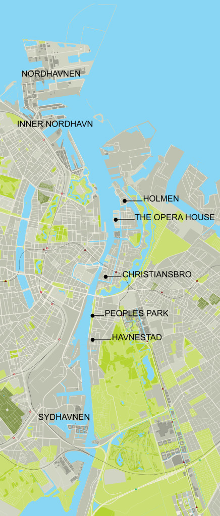
The urban areas of Copenhagen Harbour.[/two_third]
[one_third_last]
The urban regeneration of Copenhagen Harbour has been in progress for nearly two decades. As in other major cities, the basis of this transformation has involved the closedown or relocation of manufacturing companies and other harbour-based industries. Now there are already a number of urban regeneration areas on the waterfront that provide space for a good part of the 1,000 new Copenhageners every month.
This demanded a totally new mind-set on the part of politicians, landowners and investors to see the potential in redeveloping these urban districts, which would appeal to home seekers, firms, tradespeople, creative entrepreneurs and visitors.
New tendencies in society were a major boost for the start of the Harbour’s transformation. There was recognition that the future of Copenhagen should be perceived in terms of a knowledge-city with authentic, idiosyncratic urban districts, which could attract new residents and businesses, but also hold onto the people, who already populated the city.
It took about twenty years for Copenhagen to become one of Europe’s most popular cities. It is modern, fashionable, safe, democratic, business-friendly, family-friendly, recreational, green and clean.
It is probably the areas lining the Harbour that give the clearest picture of the city’s general development.
[/one_third_last]
Mainly because the Harbour incorporates this fascinating mixture of historical areas and newly developed urban districts.
Although all of the new urban districts along the waterfront share a close relationship with the water, at the same time they could not be more diverse. All were inspired by the geography of the setting, the existing buildings and their former use, and the different ways they related to the water. Which will be illustrated by examples below.
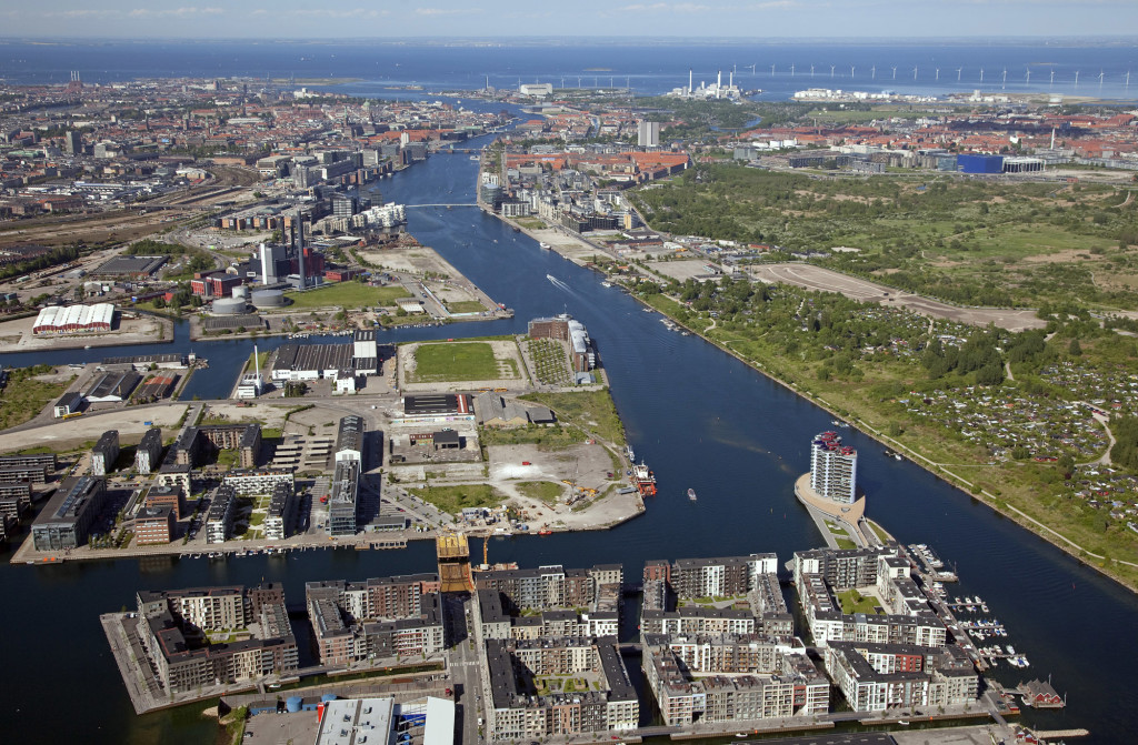 Copenhagen Harbour from south.
The central factor in the development of the central areas was a new optimism
By now the first generation of transformation projects is complete and familiar. The 1990s saw a lot of new hype about urban living. This was the kick-start for the transformation of Copenhagen Harbour.
To start with, the concentration was on the Inner Harbour, well-defined areas such as military, industrial and harbour sites. For decades they had stood out as somewhat alien elements in the overall urban picture.
For four hundred years “Holmen” had been a closed, military area. Now it houses many of the city’s institutions for artistic education. The school of architecture, the film school, the conservatory and the academy of dramatic art are now neighbours to residential developments in both existing and newly created buildings. And let us not forget the new Opera House! Ancient trees, canals and moats have been preserved, playing a vital role in the special, idyllic atmosphere of the area.
“Christiansbro” used to be the site of a machine manufacturer with vast functional workshops. It was situated slap in the middle of an urban neighbourhood dating from the 1600s, constructed in the Dutch style. Today it’s an office area. It faces the Harbour entrance with an architectural structure that reads the voluminous warehouses of the nineteenth century. There are also houses on the canals in blocks, which assimilate the proportions of the oldest buildings.
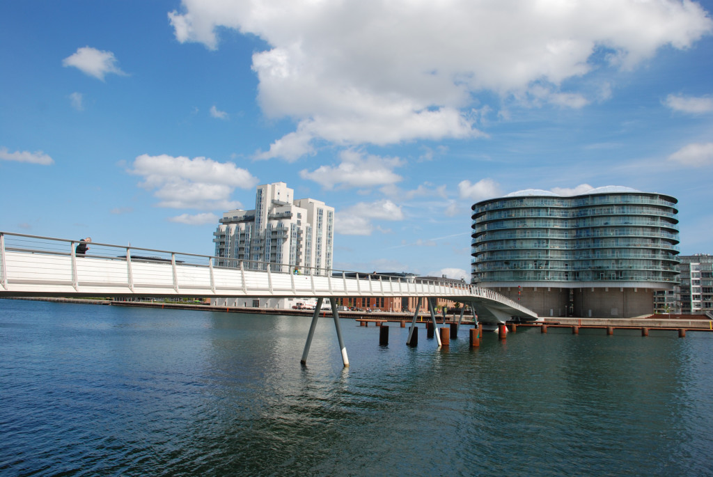 Bryggebroen, Copenhagen Harbour.
For 80 years “Havnestad” was the site of a soya bean processing plant. Today it is a residential district. As well as a number of new constructions, there are also houses developed from converted silos. There is also “Peoples Park”, a public park with grass lawns, informal sports facilities, a lido, water-polo field and kayak track. In the summer it is one of the most popular venues in the city.
Another generation of regeneration projects – Sydhavnen canal district
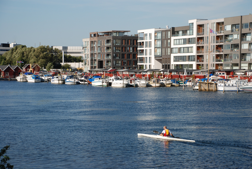 Sluseholmen.
Sydhavnen (The South Harbour) was established in the mid-1900s – a reclaimed space, designed like peninsulas hooked on to the city, and with spacious basins for the mooring of relatively large ships. Everything was rational and geared to the modern unloading and loading of ships.
In total Sydhavnen comprises 120 hectares, making it a much more ambitious regeneration project than any before it.
In 2000 an innovative collaboration between the City of Copenhagen, Port of Copenhagen, the Ministry of Environment and Energy and the National Buildings Association, “Freja” led to a master plan for Sydhavnen. Based on the concept of Copenhagen’s traditional, closed-in blocks, they created a whole new type of village – the canal village. Instead of the green gardens of the suburbs, residents would be surrounded by water and have their own moorings. A harbour bath opened in 2012 for year-round bathing, followed by a spell in the sauna.
12 years later, half of the Sydhavnen project has been completed, and the area today comprises approx. 5,000 residences and 10,000 jobs.
Approximately 30 architects were responsible for the design of the dwellings in Sydhavnen, many of which are highly expressive and constructed in new materials. Sydhavnen is unlike any other area in the city and appeals to many of the younger generation.
At the edge of the Sydhavnen there is a shopping centre and several hotels, which link the South Harbour to the City.
“The Water Bus”, collective traffic on the water, today sails to Sydhavnen, and the first of two bridges connecting the peninsulas are now in use.
Nordhavnen – authentic, distinctive, diverse and complex
 Århusgadekvarteret view from the harbour.
[two_third]
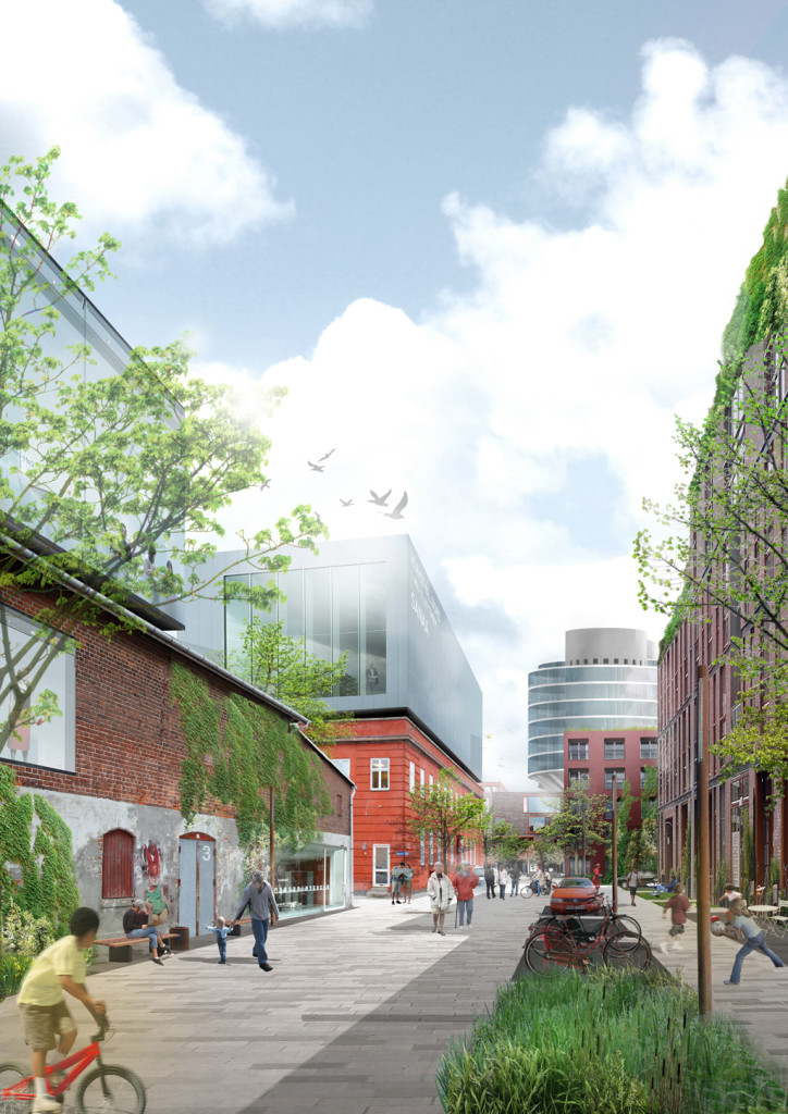 The future scenario from the area of Århusgade
[/two_third] [one_third_last]
While totally unique, Nordhavnen (The North Harbour) also offers a reinterpretation of Copenhagen. Nordhavnen is an “area of opportunity”, which creates a close relationship between land and water and focuses on the transition by offering recreational options both next to and on the water. At the same time this new district conforms to the scale and identity of Copenhagen.
The realisation of this district has just begun and will continue for the next 30 – 40 years. The project will create space for a total of 40,000 residents and 40,000 jobs.
The North Harbour is Copenhagen’s new waterfront district. The character of the district will be rooted in the long history and strong identity of the area – the history of the Harbour and the qualities of being so close to the water.
[/one_third_last]
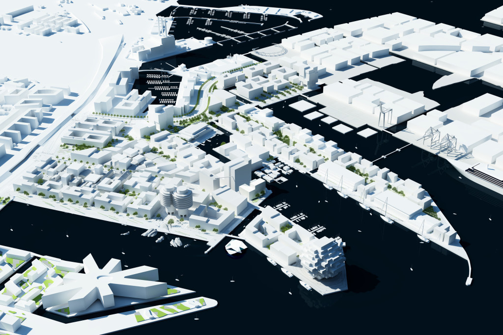 The model of the interventions in the Nordhavnen area.
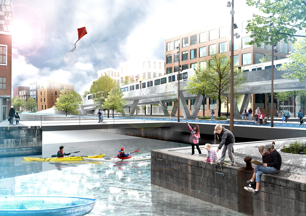 A rendering of the Nordhavnen area.
The Inner Nordhavn, the first phase of construction, is a special environment from the point of view of the city and its cultural history. There are many buildings worthy of preservation, narrow lanes and a visible narrative of the site’s past. The first districts will stand on the shoulders of this narrative, and large parts of its character will be preserved, even though the area will be transformed into a diverse urban district.
With its narrow lanes, contrasts, compressions and various styles, its staggered, asymmetrical use of space, its blocks composed of several units, the variation of its frontages and its robust, solid expression, the Inner Nordhavn will be a modern interpretation of Copenhagen’s existing districts. Modern add-ons, green roofs, green edge zones, and new buildings will all assist in the reinterpretation of the Copenhagen we know, and give the capital a major update.
The low, intimate village structure will afford protection against wind and allow the sun to reach the squares and streets. There will be concentrated areas with shops and other extrovert functions such as restaurants and cafés, large squares with room for markets, concerts and other events, and smaller squares full of local charm. There will be scope for leisure activities both next to and on the water. All these, together with informal rendezvous points throughout the district, will add to the vibrancy and interest of the city.
The Harbour – the city’s “blue” venue
Infrastructure is of vital significance in the creation of a city’s connection and cohesion. Copenhagen Harbour is no exception.
The last 10 years saw the construction and opening of two new bridges, while several more are under construction.
The city’s first Metro, which opened in 2002, crosses the Harbour. The future Metro Cityring will border onto the Harbour. Recently a decision was taken to look into the possibility of metro connections to Nordhavnen and Sydhavnen.
In addition, the “Water Bus” (Copenhagen’s floating bus route) was recently extended both south and north, so many of the new urban districts have access to this floating transport facility.
The new infrastructure is incredibly important in terms of the city’s ambition for the Harbour to become the city’s “blue” gathering point, serving both Copenhageners and visitors to the city.
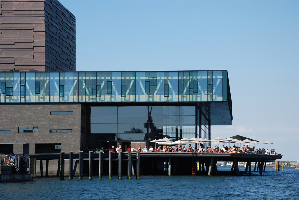 The Royal Theater Play house.
Harbour baths, bathing beaches, mooring points for canoes, kayaks and motorboats, recreational pursuits both next to and on the water, cultural venues, restaurants and cafés are already inviting Copenhageners and tourists to come and sample the pleasures of the Harbour. And every day sees the appearance of new facilities and functions.
