Gdańsk is the city of a thousand years of rich history. Since the medieval times until the beginning of XIXth century it was recognized as the largest Polish city and one of the major centers of trade in the entire Europe. This position was based on the location of the city in the mouth of Vistula river delta, which was used for shipping enormous amounts of grain and other crops from Poland to the western and northern parts of Europe. Gdańsk derived its power also from being the one of the most important members of Hanza – the medieval association of trade cities [1].
For the purpose of developing the cargo handling activities in the middle ages the large inland harbor was constructed on the embankments of Motława River with famous Granary Island. These structures decayed in the end of XIXth century. Since then the Motława River Harbor has been gradually abandoned, and the wartime destruction has completed the process of removal of the port activities from this area [2].
In the course of the post-war redevelopment and expansion, the modern, deep-water terminals were also created. These structures are being gradually developed until today. Recent investments and developments in this sector contribute to the fact that Gdańsk is gradually regaining its historical importance of the main harbor in the Baltic. At the same time the city – the capital of Pomerania province and of the Tri-City Metropolitan Area – has become one of the major business and tourist destinations in Poland and one of the strongest urban centers within the Baltic Sea Region. Its harbor is constantly under expansion and reconstruction, which makes possible interesting new waterfront and waterfront-related development developments. These processes include also preservation and reuse of some of the heritage buildings and objects as well as reintroducing the historic urban landscape of the old, medieval harbor.
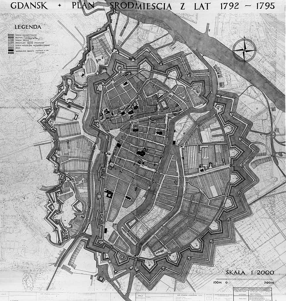
Medieval structure of Gdansk City Center. Developed by S. Michel and S. Philip. Author’s own archives. (fig. a)
Redevelopment processes of Gdańsk historic waterfront
In the very end of the World War II, in result of the siege of Gdańsk in 1945 the majority of the historic urban center of the city was completely destroyed. This included also the elimination of huge majority of the heritage buildings and facilities located within the boundaries of the historic port area. Very few of them have been carefully rebuilt within the process of post-war reconstruction of the Gdańsk Main Town (historically most important part of the city center).
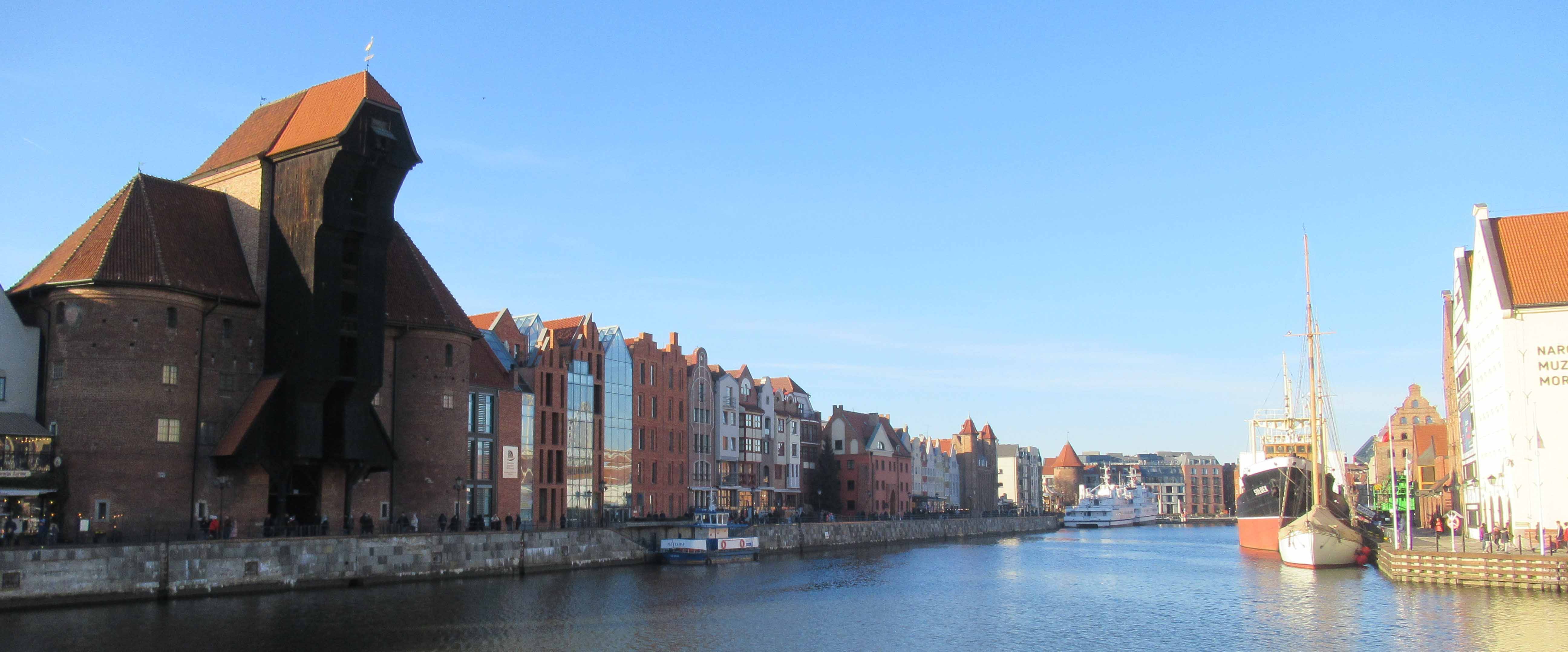
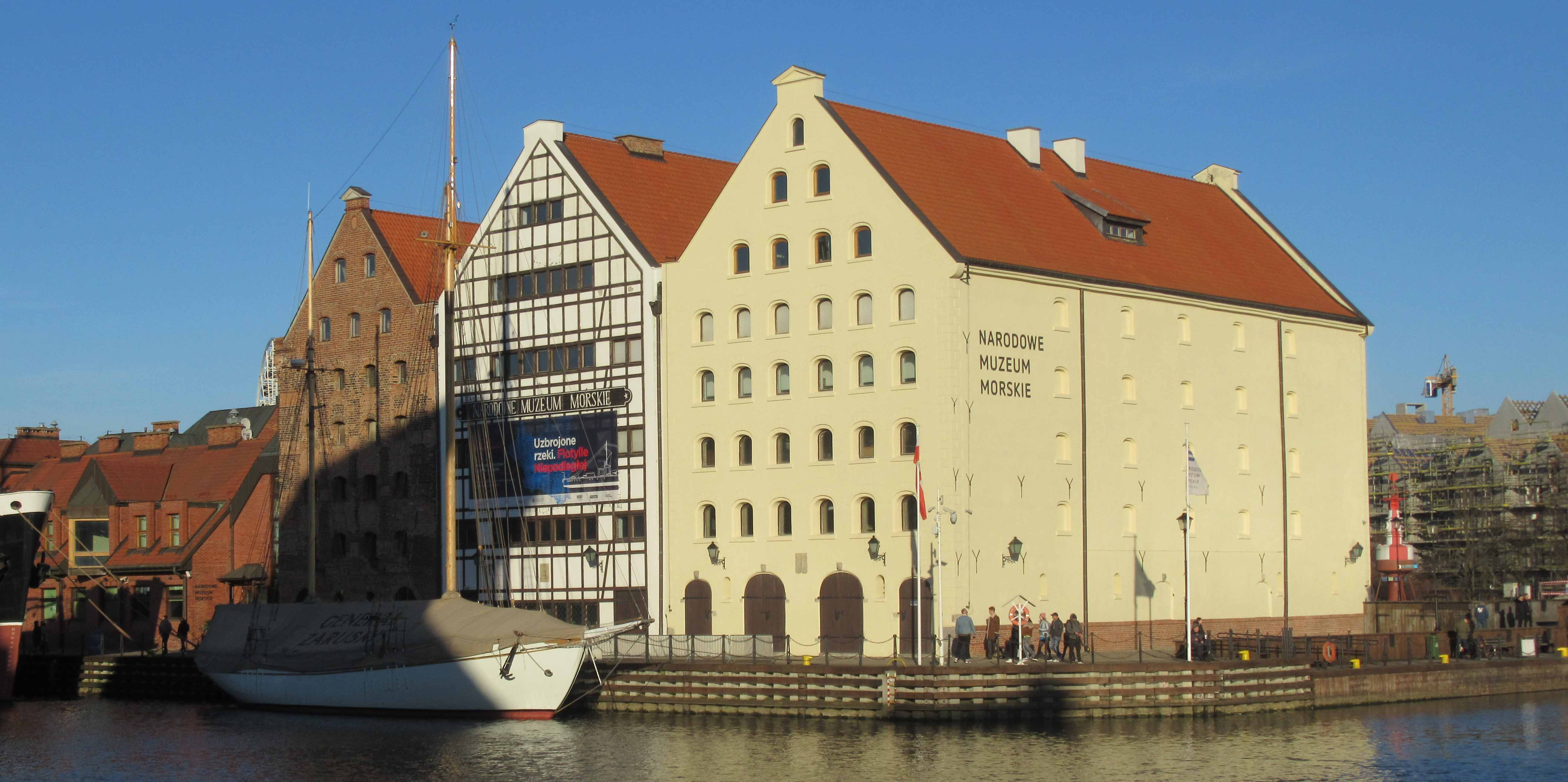
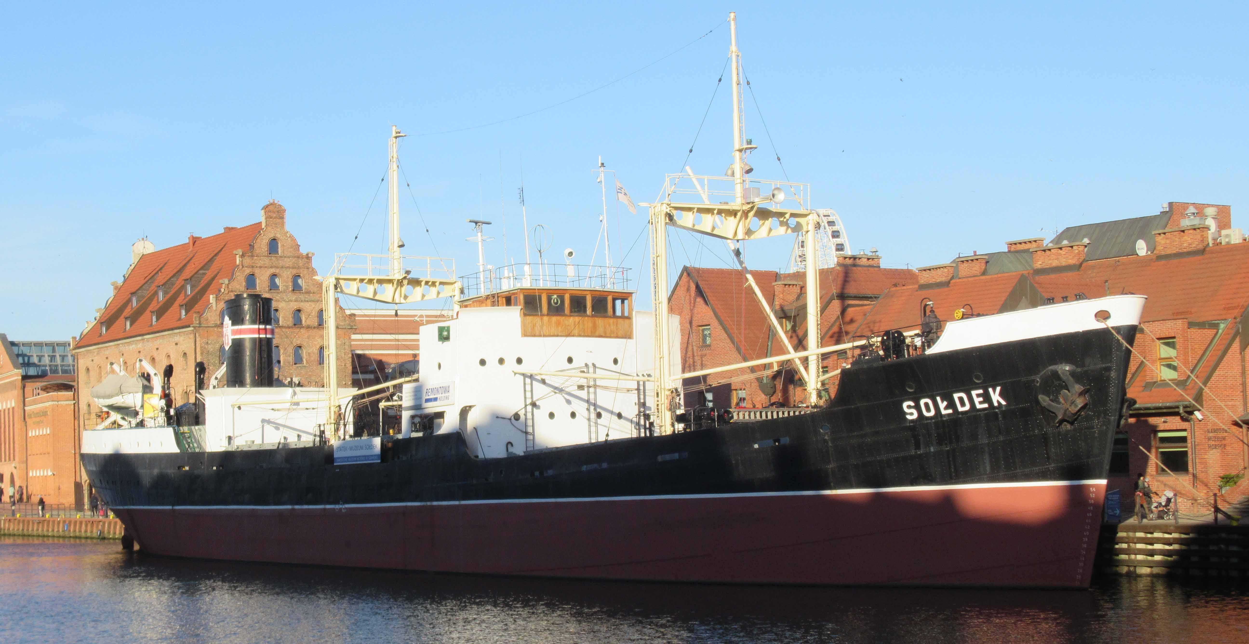
Within this group one should mention the Old Crane, a building of the medieval origin, once used for shifting cargo and for installing the masts on the sail ships. Rebuilt shortly after the war, it houses now the National Maritime Museum (see fig. b). In addition to this, three historic granaries were rebuilt on the opposite side of the Motława river, which also house part of the museum/s exhibition. This complex represents in the most accurate way the way the historic port used to look like before the times of WWII destruction (see fig. c). Also, the presence of the historic ships, moored permanently on the neighboring embankment, contribute to the construction of the image of the historic port (see fig. d).
Riverside of the Gdańsk Main Town, including the medieval Old Crane, rebuilt after the WWII. Picture by P. Lorens. (fig. b)
Old granaries rebuilt after the war to house part of the National Maritime Museum exhibition. Picture by P. Lorens. (fig. c)
Historic ship S/S Sołdek moored in front of the National Maritime Museum complex. Picture by P. Lorens. (fig. d)
Unfortunately, most of the waterfront sites was left unused until the socio-economic and political transformation of Poland in 1990-ties. In addition, parts of the city waterfront were in need of major infrastructural improvements, which made impossible any transformation of these.
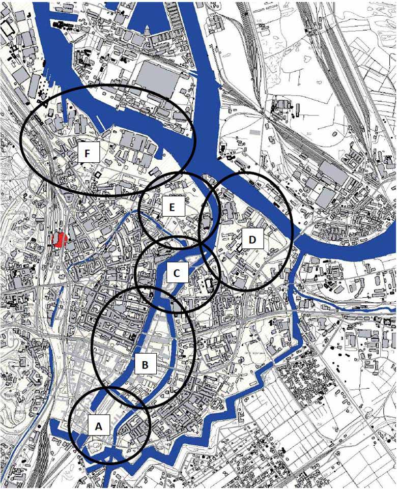
The situation has changed dramatically at the beginning of the XXIst century, when the newly reintroduced private sector started to look for new investment opportunities within the real estate market. In addition, the new city authorities started to reconsider the situation within the historic waterfront, which effected in many infrastructure improvements as well as in development of some new public institutions located within the post-industrial structures. In result, one can identify a number of transformation sites located within the historic waterfront area (see fig. e). Within many of these a number of transformation projects has been initiated, many of which include reuse and rehabilitation of the historic heritage.
Key transformation areas of the historic Gdańsk waterfront: A – gormer Kłodno railway station; B – Granary Island; C – Ołowianka Island; D – Polski Hak peninsula; E – Brabank; F – Young City. Developed by P. Lorens. (fig. e)
Granary Island
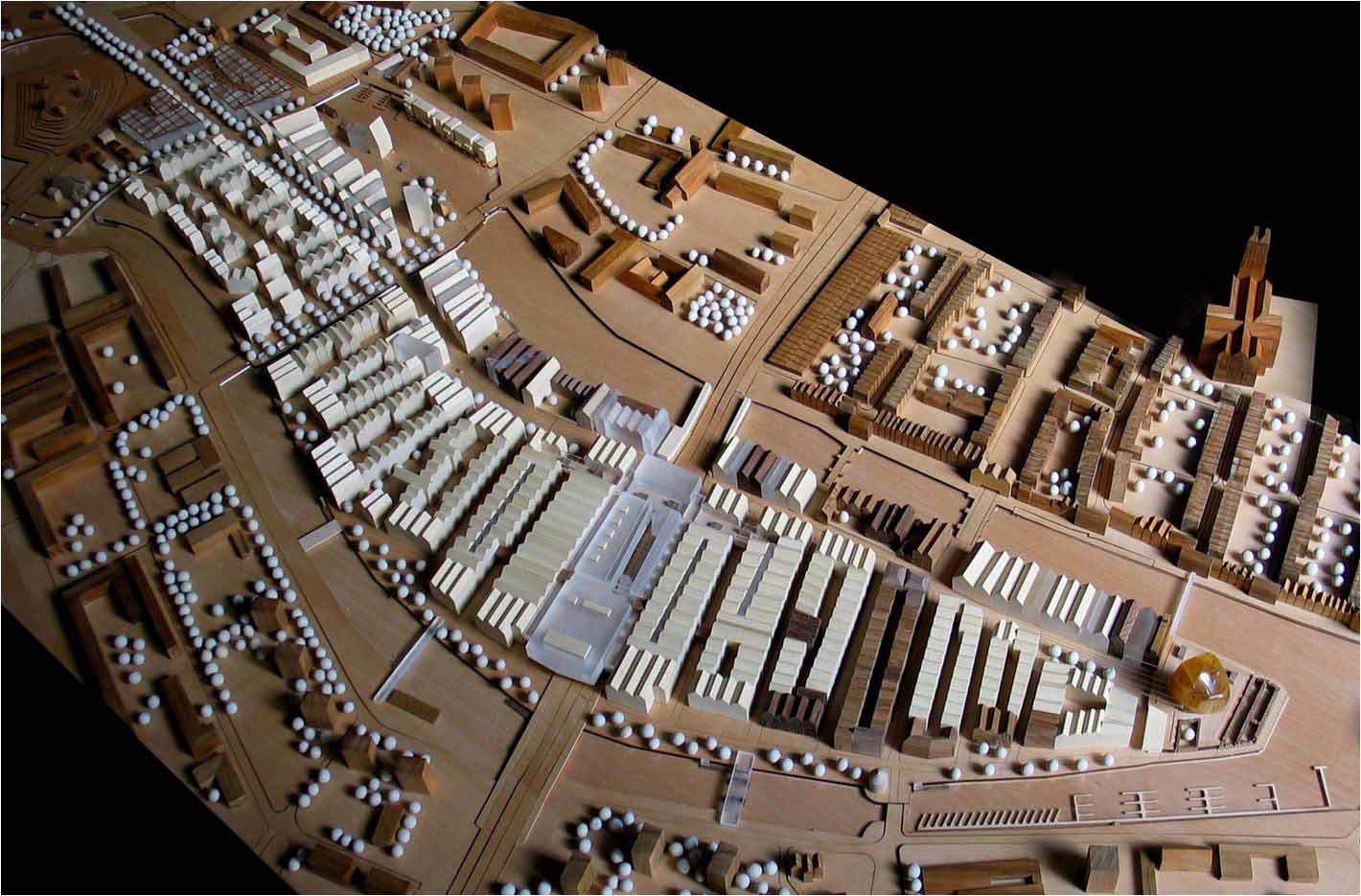
For the purpose of defining the contemporary redevelopment concept for the Granary Island area a number of plans and studies were made to serve as blueprint for complex redevelopment of the site. The final attempt was developed – on the basis of the results of the urban design workshop – by Fischer Atelier in 2007 (see fig. f). Afterwards, this study served as the basis for developing final version of the planning regulation for the site. Since acceptance of this by the City Council, the proper redevelopment process was started, although it goes piece-by-piece and plot-by-plot. This is also further spurred by development of the new public waterfront promenades and new transportation and infrastructure systems. In result, the entire area is now considered to be “one huge building site”.
Model of the proposed redevelopment scheme of the Granary Island by Fischer Atelier. Picture by P. Lorens. (fig. f)
On that basis a number of individual project are currently being developed, which include three major types of intervention:
- Reusing the historic buildings (mostly granaries) for the new (mostly commercial) purposes – the good examples of these are newly opened restaurant and hotel complexes (see fig. g, fig. h);
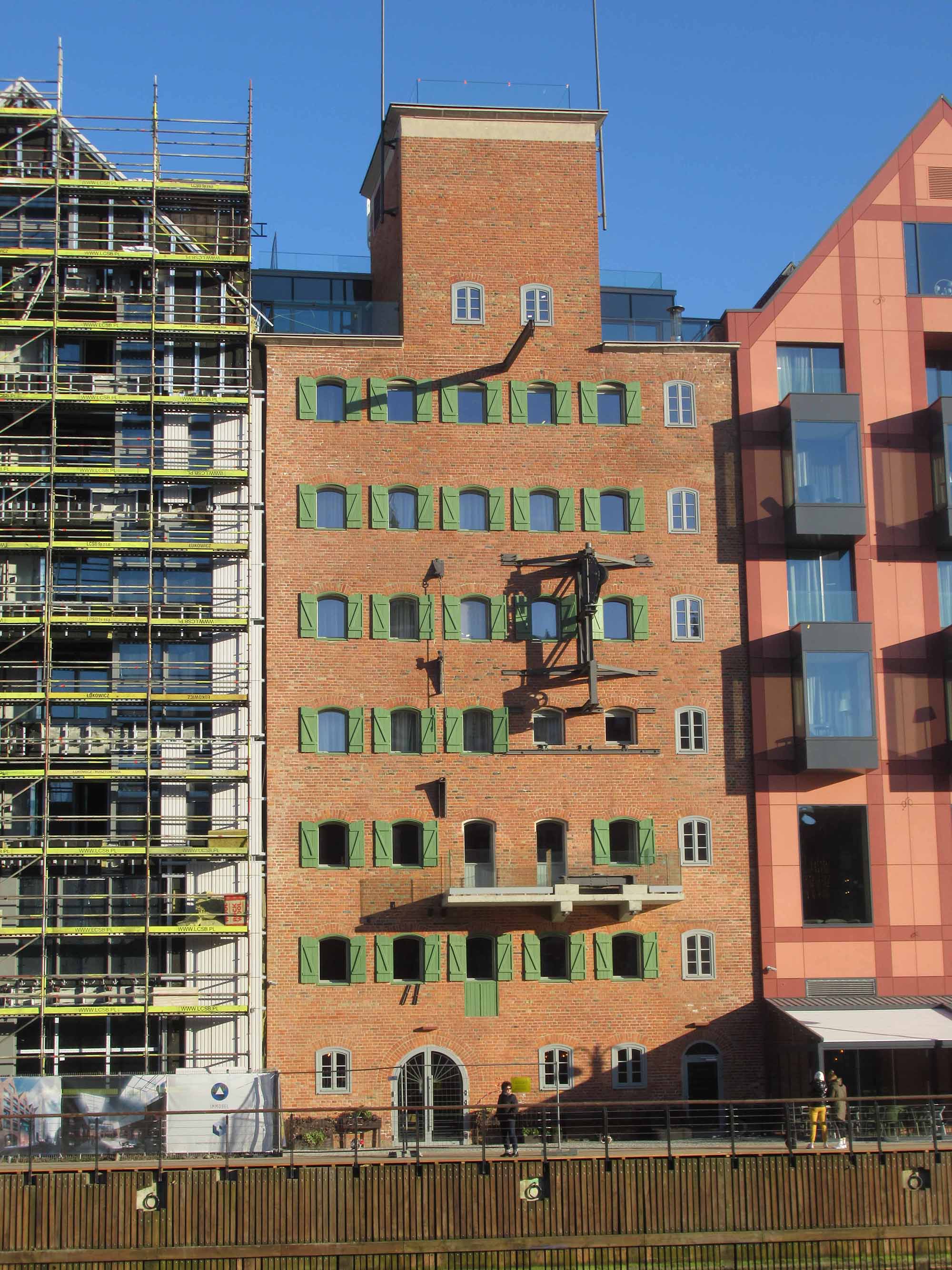
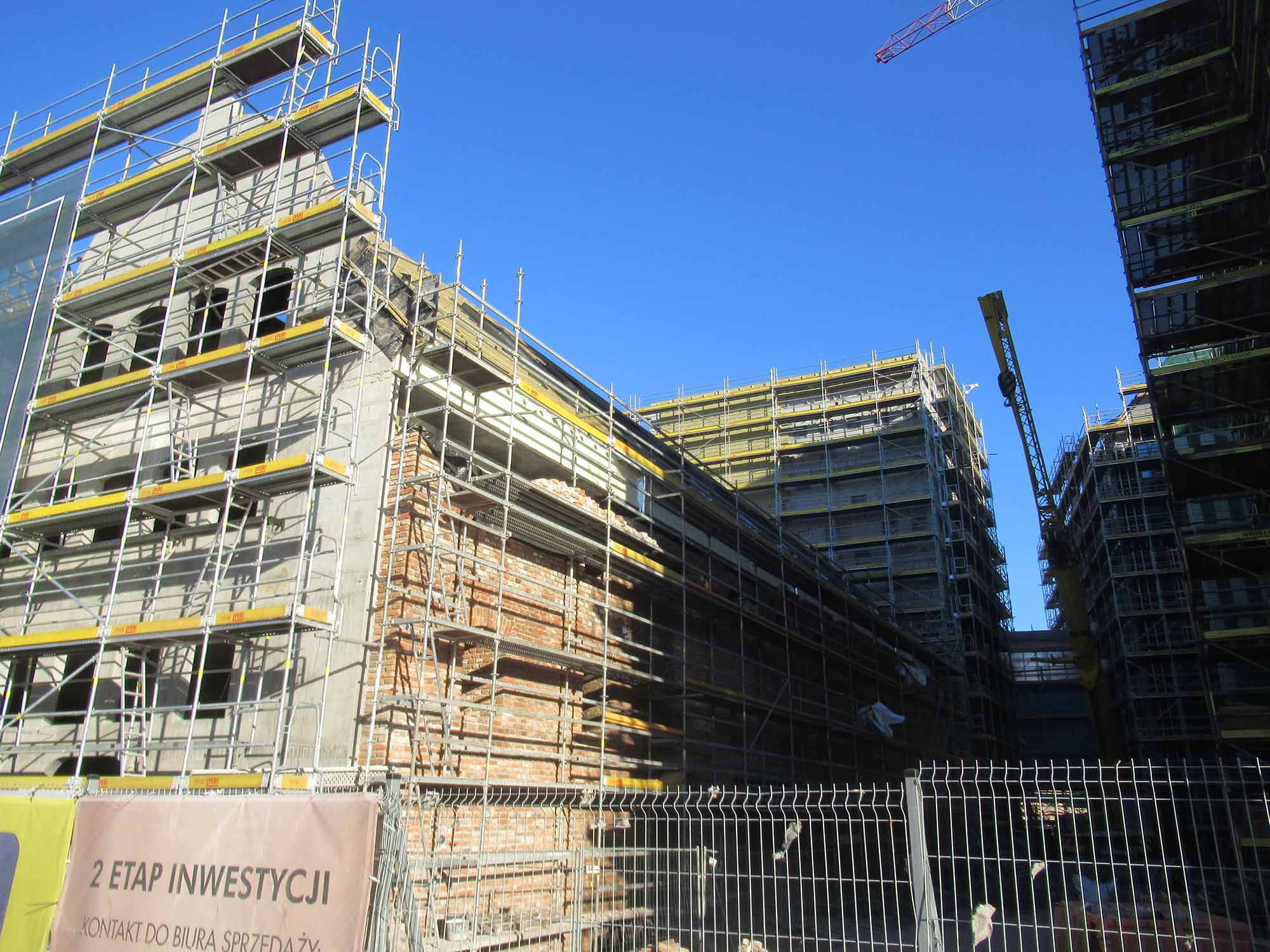
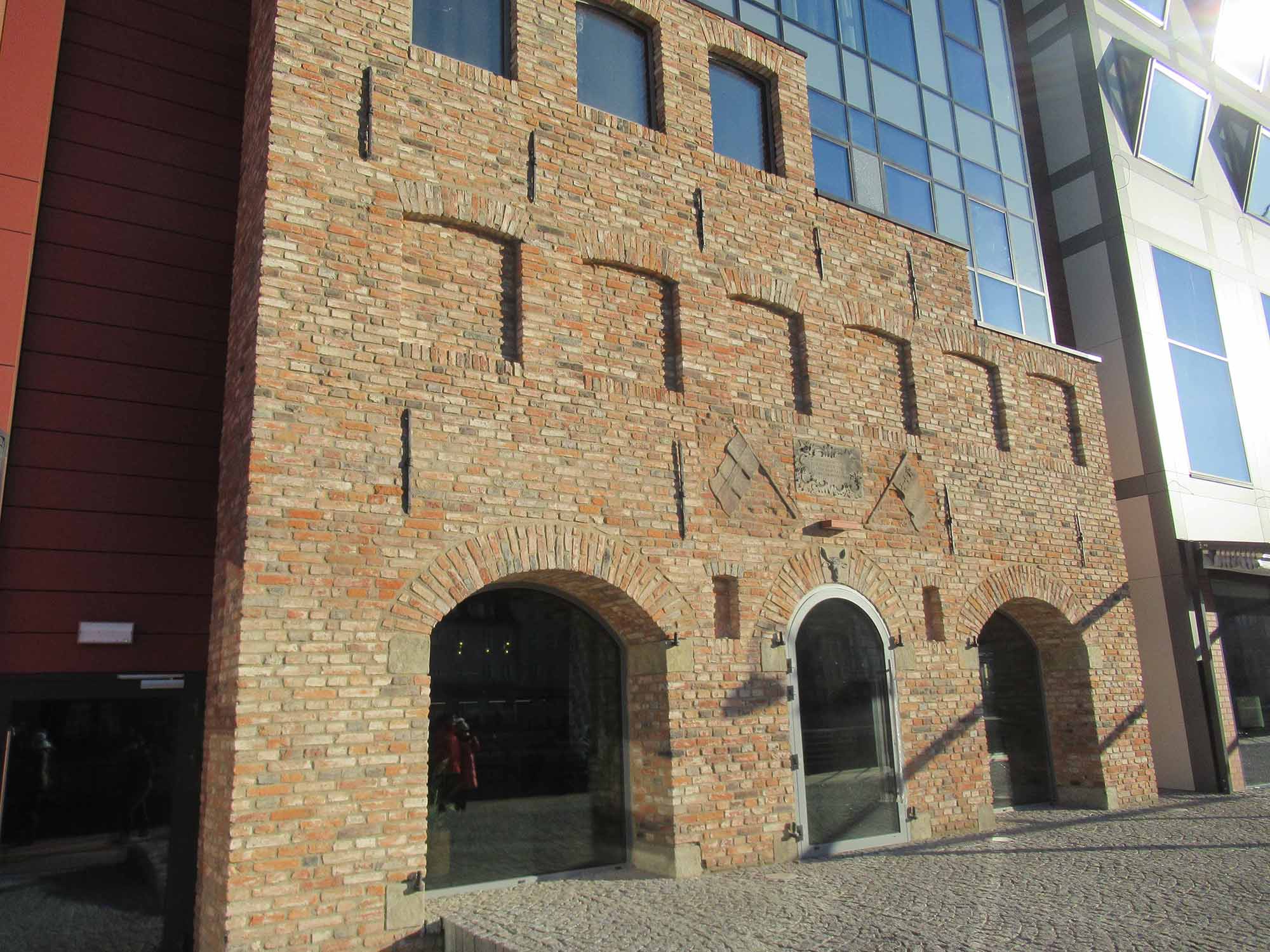
- Reusing parts of the remaining historic granary walls as important components of the newly built structures – in this case the historic remnants are just parts of the new buildings (see fig. i, fig. j);
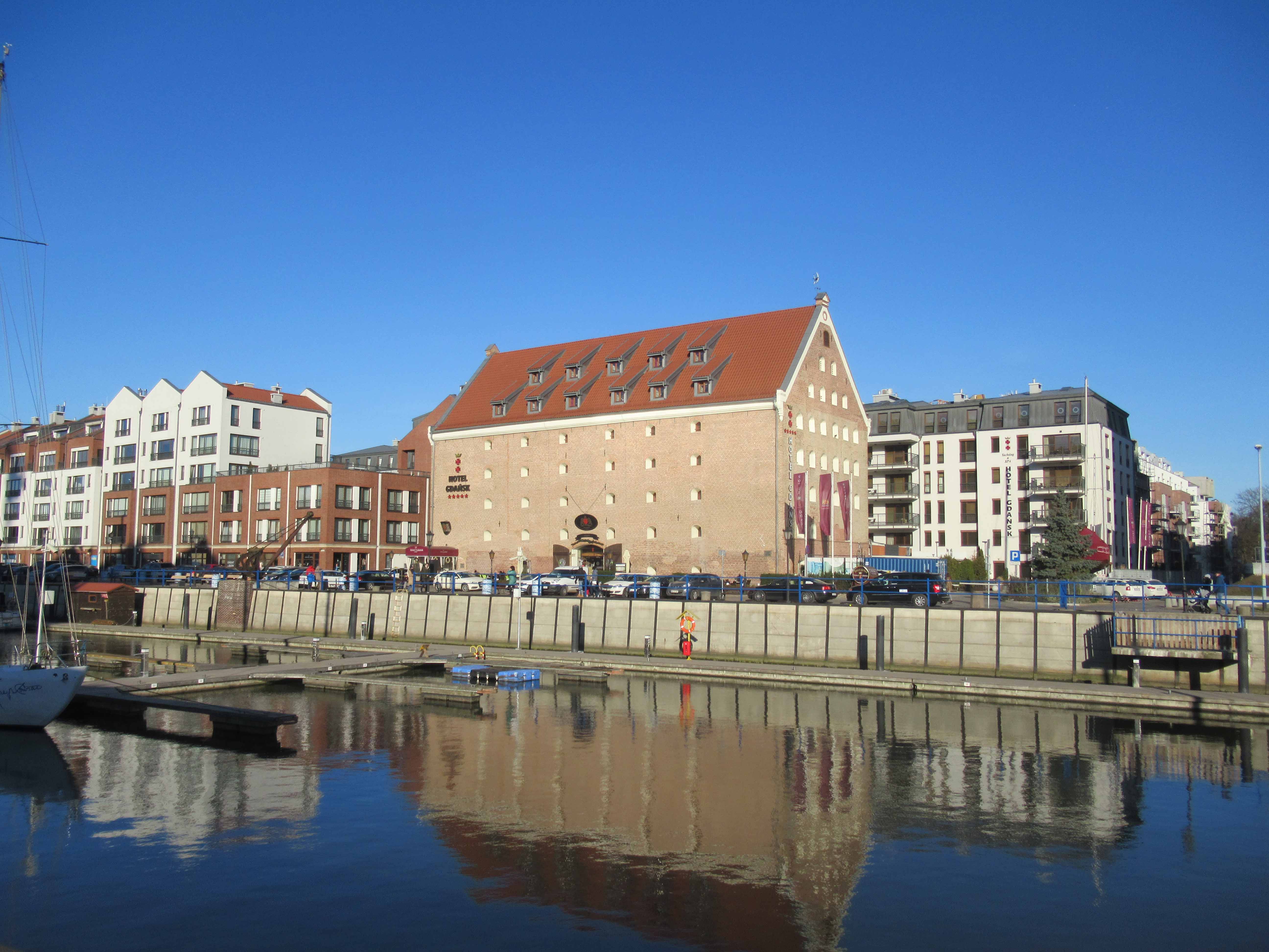
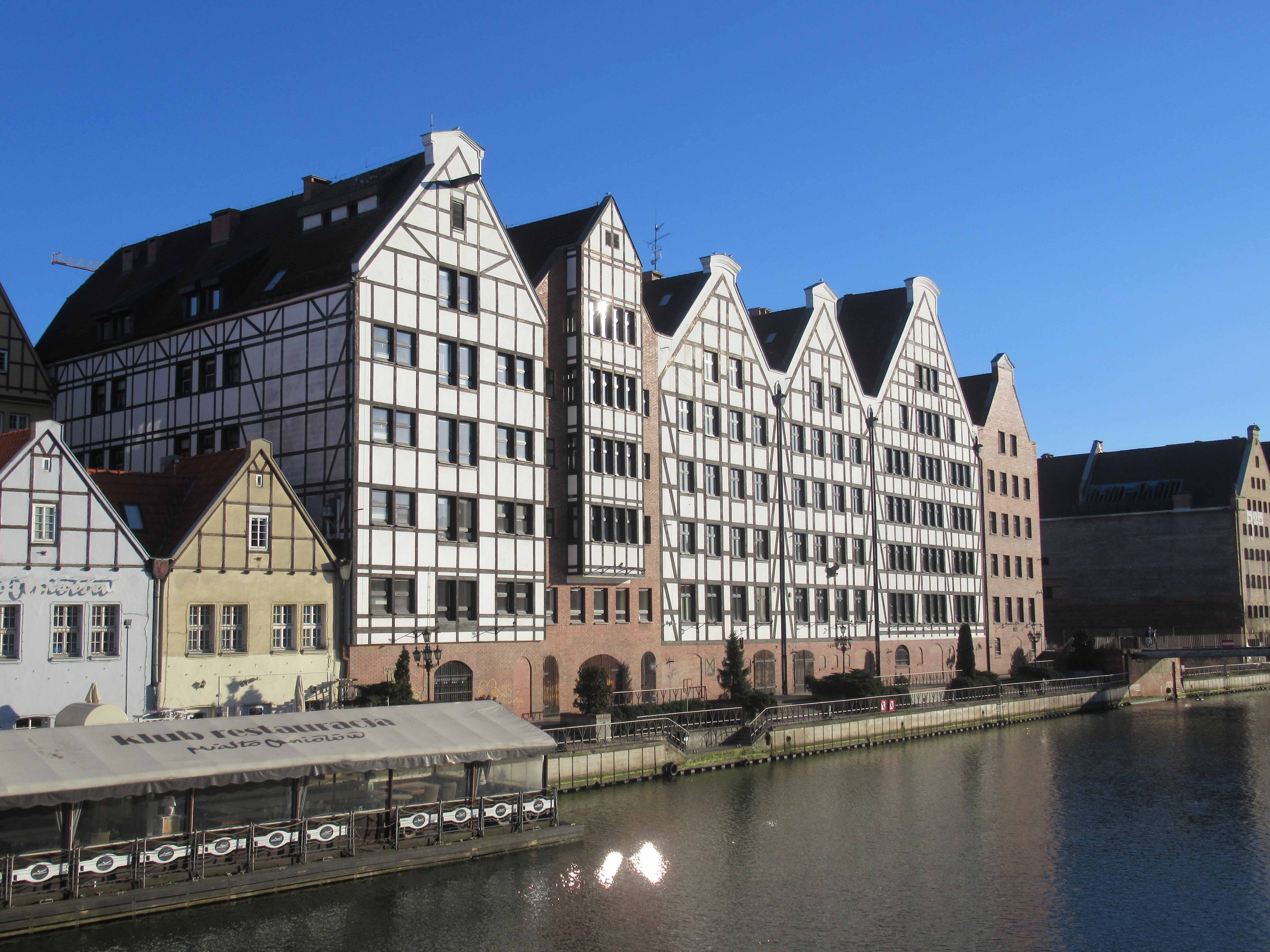
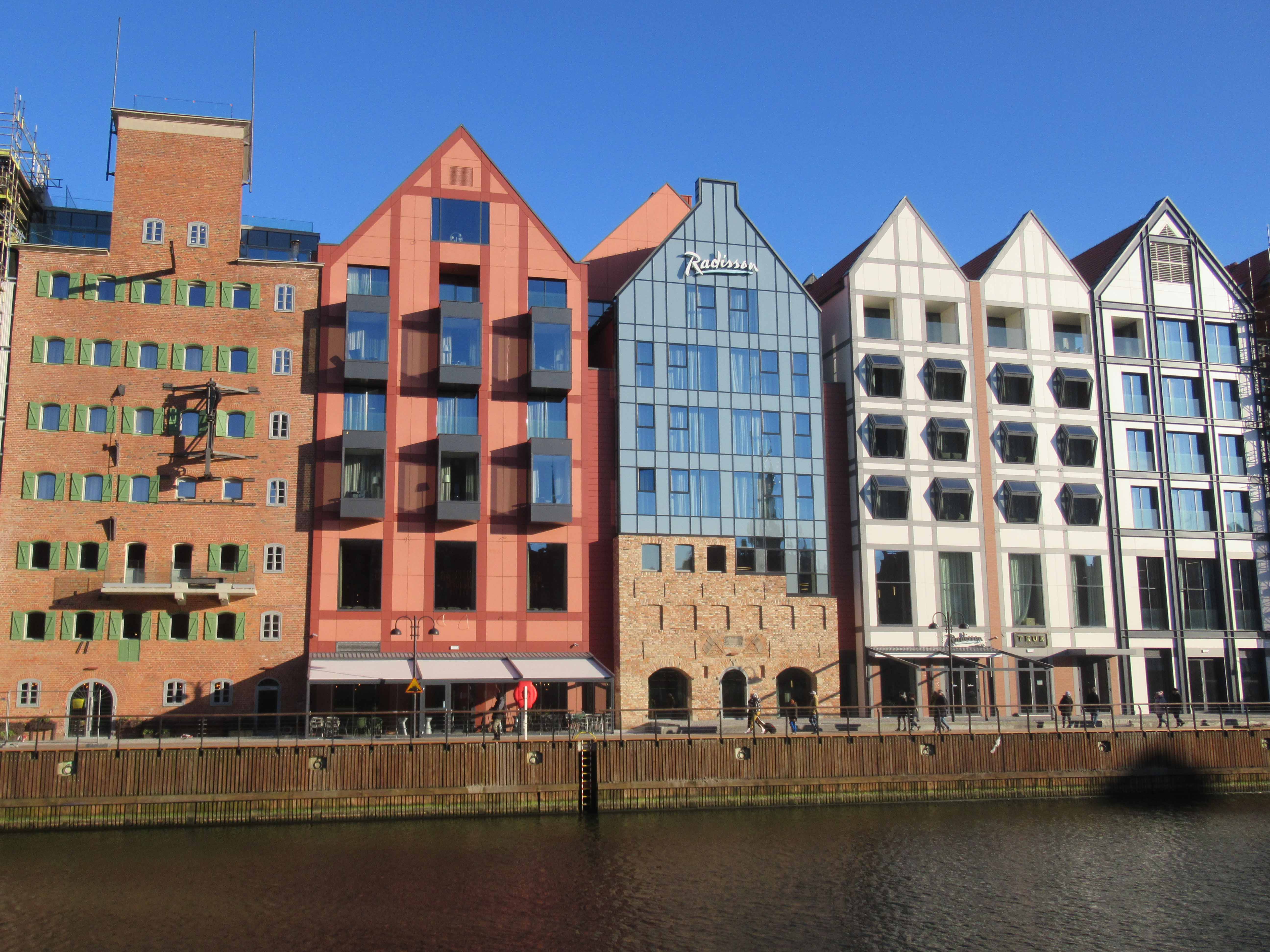
- Redeveloping the historic landscape of the area through introducing buildings which shape and structure resemble the historic originals (see fig. k, fig. l).
Granary building of the Renaissance origin – recently converted to the hotel and restaurant complex. Picture by P. Lorens. (fig. g)
Granary building of the interwar origin – recently converted to the hotel and restaurant complex. Picture by P. Lorens. (fig. h)
Walls of the historic granaries – recently incorporated in to the new commercial complex. Picture by P. Lorens. (fig. i)
Walls of the historic granaries – recently incorporated in to the new commercial complex. Picture by P. Lorens. (fig. j)
Introduced new buildings which shape and structure resemble the historic originals. Picture by P. Lorens. (fig. k)
Introduced new buildings which shape and structure resemble the historic originals. Picture by P. Lorens. (fig. l)
Ołowianka Island
North to the Granary Island one can find Ołowianka Island, a much smaller piece of land but also much less destroyed during the WWII. Moreover, the process of its transformation is much more advanced than in the case of the above described complex. In this case one should point out successful transformation of the key historic buildings, which include:
- Redevelopment of the historic power plant complex – which has become home to the Baltic Symphony Hall as well as a small-scale congress center (see fig. m);
- A new hotel, located in the building of the Royal Granary, adjacent to the mentioned above congress centre (see also fig. m);
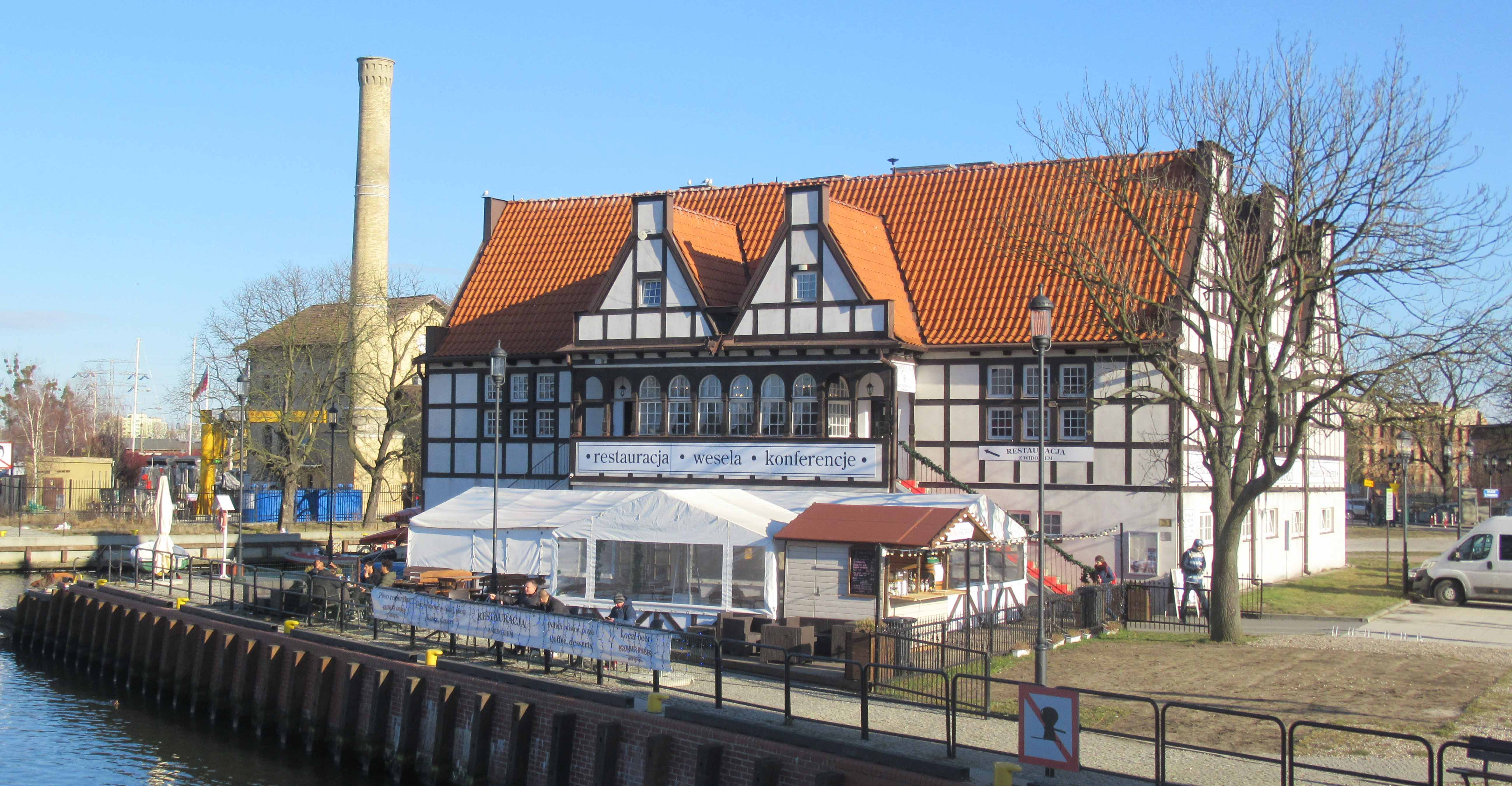
- An old Boat House (still in use by rowing clubs) being one of the few remaining buildings from the late XIXth century in the area as well as the only one which original function is still in place (see fig. n).
Complex of the Baltic Symphony Hall (occupying the old power plant building) and the adjacent Royal Granary (now – hotel). Picture by P. Lorens. (fig. m)
Historic boat house – still in use. Picture by P. Lorens. (fig. n)
Young City
North to the Motława Waterfront, on the embankment of the Vistula River, one can identify the third complex of historic importance – which is the Young City. Its site was previously occupied by the historic Gdańsk Shipyard, developed in the second part of XIXth century. Most of its original structure is still in place, being the very interesting witness of Gdańsk maritime tradition and history. It was here that the Solidarity movement challenged the communist system in Poland and encouraged freedom across Eastern Europe. Former shipyard is recognized by public not only as place of historical importance but also as symbol of greatness and spirit of the city.
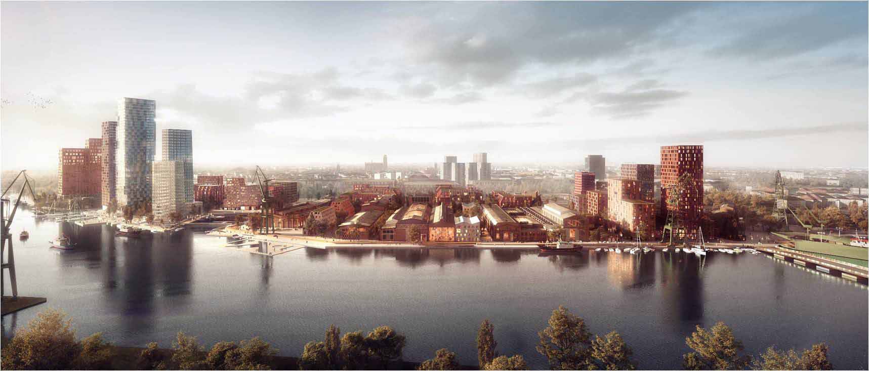
After the shipyard’s bankruptcy in 1997, the site has become a home to the newly conceptualized large-scale urban development project. Being planned since 1999, nowadays it starts to be implemented [3]. There are many interesting projects located within this site, but from the heritage preservation point of view the most interesting is the case of the plot named Imperial Shipyard. This name comes from the fact that in the turn of the XIXth ad XXth century this facility belonged to the German State and was named Kaiserlische Werft. Within its borders one can identify a number of well preserved shipyard buildings, now planned for housing the new urban functions [4]. This structure is to be complemented by new developments, both in form of in-fill small-scale buildings and in form of medium- to high-rise buildings [5] (see fig. o).
New vision for reshaping the historic Gdańsk Shipyard. Developed by Henning Larsen Architects. Source: Author’s archives. (fig. o)
Conclusions
The historic harbor of Gdańsk can be described as under major redevelopment. A number of specific projects are both under way and planned for the near future. Therefore, one can conclude that this area is undergoing major transition. This makes the site one of the most dynamically transforming parts of Gdańsk city centre [6].
First projects are already completed, which allows speculation on the potential future of the other transformation areas. On that basis one can conclude that the following issues are taken into consideration:
- Reintroducing the “historic harbor” image – through development of the buildings and complexes that contribute to the process of bringing back the features of the landscape that vanished during the World War II;
- Adaptation and reuse of the very few remaining historic buildings – mostly for the commercial purposes;
- Incorporating the remaining parts of the non-existing (due to their war-time destruction) buildings in the newly erected structures.
In result, an interesting urban landscape is created, being the mixture of both historic and new elements.
Notes
[1] More on this in: Cieślak, E, Biernat, Cz. (1975), “Dzieje Gdańska”, Wydawnictwo Morskie, Gdańsk
[2] The issue of transformation of Gdańsk city centre in XIX and XXth centuries is discussed in: Lorens, P. (1998), “Przekształcenia obszaru śródmieścia Gdańska w latach 1793-1945”, in: A. Kostarczyk (ed.), Gdańsk pomnik historii. Teka gdańska 3, Regionalny Ośrodek Studiów i Dziedzictwa Kulturowego, Gdańsk
[3] More in this in: Lorens, P, Lipiński, J (2016), “Młode Miasto Gdańsk. Laboratorium miejskich procesów rozwojowych”, Monoplan, Warszawa
[4] This issue is elaborated in detail in: Lorens, P, Lewicki, J (2018), “Młode Miasto Gdańsk. Zasady kształtowania przestrzeni Młodego Miasta w kontekście wartości zabytkowej i wytycznych konserwatorskich dla zespołu dawnej Stoczni Gdańskiej”, Monoplan, Warszawa
[5] https://stoczniacesarska.pl/en/
[6] More on contemporary transformation of Gdańsk city centre in: Lorens, P (2018) “Transformacja śródmieścia Gdańska – wybrane aspekty kształtowania nowego oblicza metropolii”, in Z. Zuziak, A. Grzybowski (eds.) Centra miast metropolitalnych w Polsce, Wydawnictwo Wyższej Szkoły Technicznej w Katowicach, Katowice
References
Cieślak, E, Biernat, Cz. (1975), “Dzieje Gdańska”, Wydawnictwo Morskie, Gdańsk.
Lorens, P. (1998), “Przekształcenia obszaru śródmieścia Gdańska w latach 1793-1945”, in: A. Kostarczyk (ed.), Gdańsk pomnik historii. Teka gdańska 3, Regionalny Ośrodek Studiów i Dziedzictwa Kulturowego, Gdańsk.
Lorens, P, Lipiński, J (2016), “Młode Miasto Gdańsk. Laboratorium miejskich procesów rozwojowych”, Monoplan, Warszawa.
Lorens, P, Lewicki, J (2018), “Młode Miasto Gdańsk. Zasady kształtowania przestrzeni Młodego Miasta w kontekście wartości zabytkowej i wytycznych konserwatorskich dla zespołu dawnej Stoczni Gdańskiej”, Monoplan, Warszawa.
Lorens, P (2018) “Transformacja śródmieścia Gdańska – wybrane aspekty kształtowania nowego oblicza metropolii”, in Z. Zuziak, A. Grzybowski (eds.) Centra miast metropolitalnych w Polsce, Wydawnictwo Wyższej Szkoły Technicznej w Katowicach, Katowice.
Head Image: Introduced new buildings which shape and structure resemble the historic originals. Picture by P. Lorens.
