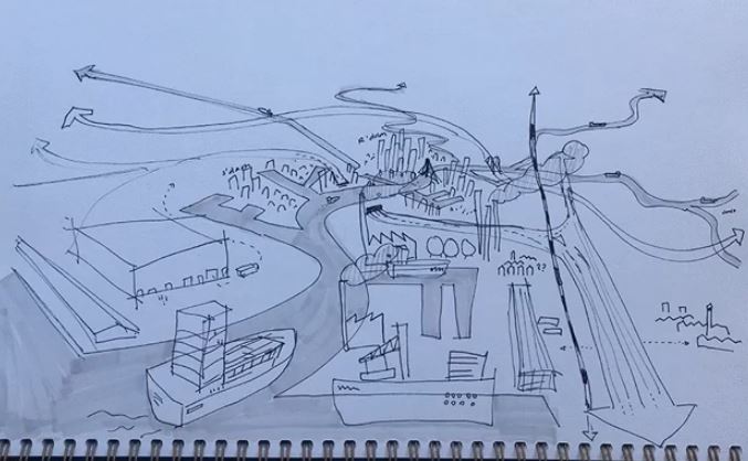
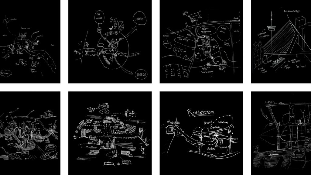
Imagine: You are asked to draw a port-city from memory. What would you put on paper? Do you think of harbours? Water, docks, cargo, moving loads, and ships? If your drawing shows these elements, don’t be surprised. Sixty-five graduate students also took on the challenge in 2020 [1]. Another group of fifty-five graduate students did so in 2021. In answering: “draw the port-city of Rotterdam by mind”, the drawings of the participants displayed exactly the above features. Of course, this makes sense. A port just happens to be a place on the water in which ships shelter and dock to (un)load cargo and/or passengers. A harbour is a sheltered place too, and in its nautical meaning it is a near-synonym for sheltered water, in which ships may dock, especially again for (un)loading. So, all the above linguistic lemmas are there and all these are connected to imaginable objects. Apparently in a ‘port-city’, the adjective ‘port’ modifies the meaning of ‘city’ in such an extent that this echoes in the mind. Objects associated with the port form what we call a mental map. In general, putting such a map on paper displays a person’s subconscious representation of an area, and although each map is subjective, a representative sample helps to identify areas and people’s affiliation to these areas. Yet, mental maps with a strong emphasis on ports – rather than of port cities as a whole – seem very limited (see: https://youtu.be/nh1yD8noz9c/).
Harbour areas are huge, but hardly known
In general, people use to approach ports as a vague relatively large section of the city: In the urban design perspective of Kevin Lynch [2], we may call port areas a ‘district’ in our mental maps, with the river as water edge and predetermined path for ships. It is alike all those areas we know, but not know exactly. In the Rotterdam sample, students occasionally give some sort of detail: if so, they draw different areas with containers and oil drums. These are large enough to identify as specific nodes and they are used as an image of the port for decades. Also, the old-school landmark cranes are sometimes drawn clearly. They are big enough to experience when you are in the port area today, and, again, they are pictured to represent the port city for at least over a century. In contrast, the lesser-known and more-recently developed areas including huge wind turbines are seldom drawn. Likewise, the overhead cranes in the iconic non-human automated port terminals of Rotterdam are nearly absent in the maps. They are only a few years old, mostly out of view and not yet so often used as an illustration of the port area. The unobserved is never taken into account, whereas objects generally associated with ports are. It is a duality which is recognised since the birth of an experimentalist search for psychophysical correlations [3].
Public spaces in the dedicated port are poor
The limited amount of information in these mental maps can be explained quite simply. Mental maps are always based upon our experiences and upon information we have gathered over time. When we know less, we draw less. In the Rotterdam case, we only draw physically large features that we may have seen from a distance, and/or objects we presume are there. This is connected to the lack of public accessibility of the port area itself. Public space is often fenced and walled there and the street network is large gridded. Since the general public cannot access most of its maritime and industrial landscapes, few people can map the exact layout of the port area from their memory. In addition, the lack of detail in the maps also relates to the speed visitors have. Public spaces in the port area are car-dominant. An old urban design lesson teaches that we see less if we move fast [4]. Applying such lessons in a harbour may result in huge signs to be recognised and remembered [5].
Rotterdam by mind
Still, instead of a blind focus to the port, and therefore its harbours, I prefer to consider the resilient and acculturated interrelation of port and city in order to identify port cities as ‘cities’. Thus, I asked the same groups of graduate students to “draw Rotterdam by mind”, before challenging them to draw the ‘port-city’. In this question, ‘port-city’ was explicitly left out. This set of mental maps is richer in the kind of objects drawn and still they do relate to a subconscious image of port cities. Fundamentally, it makes sense that this question generates more info. Networks of public spaces are more refined outside of the port areas. Here, we can experience cities very differently and here, we move with different paces. Our paths are different, our perspectives are different, and our perceptions are different. We can be informed in various ways. Very fundamental in environmental psychology is the difference between people who know the city in mediated ways and those who reside there [6]. We may know the city by heart, or through a novel or other books. We may recall paintings or online images. We may be informed through a wide variety of social media, films and music. Despite a multiplicity of differences between individuals, their mental maps, the set of drawings show many more elements related to port cities than the ones introduced before. Remarkably, if the question is less biased, the amount of information drawn in mental maps increases.
In order to test if the information in the mental maps actually relates to an identity of port cities, we can study to what extent the drawn objects are tied to the specific port city, and thus their what we call situational conditions. And, we can relate these elements to imaginable concepts, which are deriving from the accumulating port city research. In other words, we can test if what is present in the drawings, may also be indexical in port city research texts and vice versa. The set of mental maps of Rotterdam reveal for instance buildings related to long established migrant relations, objects related to global capital, and nodes and lines related to distribution.
Beyond biases
This approach builds upon the method of mental mapping as it has been adopted in urban design, both in academia and practice, to connect histories of cities to future making [7]. It can also be seen as a continuation of participatory approaches in urban planning and policies for development [8]. Yet, it takes into account that what is drawn is “rooted and influenced by cultural frameworks of experiences”, and what is discovered in the maps reflects “the biases and values of their beholders” [9].
Within the PortCityFutures team, the update of the method is being catalysed by overlapping insights of many colleagues. By uniting among others visual ethnography, cultural anthropology, human geography, urban sociology, and port economy, the novel application of mental mapping can help to reveal hidden dimensions of port cities and understand their complex nature. At a certain point of saturation, new maps may not be surprising anymore; still, the undrawn is always out there. The intent cannot be complete, however, to discover maritime mindsets which help us to look beyond the water, docks, cargo, moving loads, and ships in the future.
A desire for Port-City union
The challenge particularly lies at the desk of the professionals of today. In their mental pictures for the future of Rotterdam, port and city remain two dichotomistic entities. This is enforced in urban governance and the urban design practice.
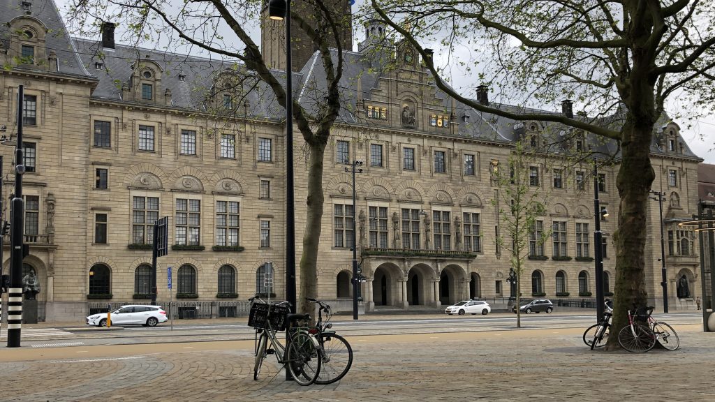
Following the privatization of the Rotterdam Port Authority in 2004, ‘port’ has been represented by this entity (private, from juridical perspective) while city has been the domain of the Municipal Government (public entity). This construct resulted in two very different approaches towards the design of public space, because each has a full mandate to design public spaces within the territory. In the ‘city’, considered as compact, the community and metropolitan scale comes to the fore, whereas in the ‘port’, a larger peripheral area including active harbors, the public space stays foremost an efficient traffic machine. This influences the mental maps of others, the general public, and professionals in training [10]. Still, in the last decade, authorities also acknowledge that the two are interrelated: “the future of the port goes hand in hand with the future of the city” [11]. They aim to offer a greater variety of living and working environments “coloured by maritime activities”, wherein traditional port-activities are gradually substituted by making and manufacturing [12]. It unfolds a desire to confirm the port-city union.
Mapping maritime mindsets in public space
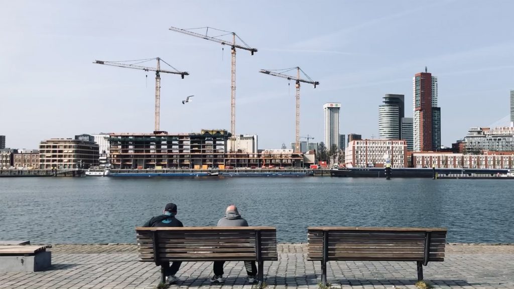
By reviewing public spaces in the proximity of the objects drawn in the mental maps, we can illustrate the unique port-city characteristics. These may help us to re-understand the age-old port-city union. Port is everywhere in the city. With a similar approach, we can reveal identities of port cities in everyday public spaces of any kind, also those not drawn in the described experiments. Many public spaces in the civic areas have such particular characteristics. For instance, about every street associates to the water, yet each emphasises peculiar land-water relationships. Most obviously, riverfronts, docks, inlets, piers, wharves, embankments, and landings come to the fore, but also, assembled together in networks, more particles form an urbanised landscape; the delta-shaped estuary of Rotterdam. Other examples could be given by all those public spaces which serve logistics, but are integrated in the differentiated, layered, and refined urban fabric of Rotterdam. Many streets serve the movement of merchandise and people, as, in essence, they have already done for ages. These are embedded in a lay-out of the distribution network, including all water-, road-, and railways, but also including a large amount of public pick-up and transfer points and public transport hubs, and/or mail shipping services and travel agencies. Multi-scalar reviews of our maps help to explicate relations between nature and artifice, as well as for example the flows of goods and people. Signs and symbols affirm that up to the smallest detail [13]. Civic areas reveal much more tangible and intangible characteristics of the port-city in addition. Perhaps more than do the huge or formally redeveloped harbour areas. Accepting such undivided images at all levels, and at all places, deforms our mental maps, and thus the images of the port-city of the future. As professionals, we may simply need to have an open mind.
Head Image | Blurred aerial view of the Port-City of Rotterdam. (© Maurice Harteveld, from Landsat/Copernicus, 2021).
Notes
[1] This article is an extended reprint of Harteveld (2020).
[2] Lynch (1960).
[3] Boring (1934).
[4] Appleyard, Lynch, and Myer (1964), and Venturi, and Scott Brown (1972).
[5] e.g. Dunlap (1992).
[6] Canter (1977).
[7] e.g. Moughtin, et al (2003), Carmona, et al (2003), Larice, and Macdonald (2013), and Sheppard (2015).
[8] e.g. Berman (2018), and Banks, et al (2013).
[9] John-Steiner (1985), and White, and Gould (1974).
[10] Harteveld (2021a).
[11] Havenbedrijf Rotterdam (2011).
[12] Programmabureau Stadshavens Rotterdam (2011).
[13] Harteveld (2021b).
References
Appleyard, Donald; Kevin Lynch and Richard Myer (1964), The view from the Road. Cambridge: M.I.T Press.
Banks, Sarah; Hugh Butcher, Andrew Orton, and Jim Robertson (2013), Managing Community Practice: Principles, Policies and Programmes (second edition). Bristol: The Policy Press.
Berman, Tal (2018), Public Participation as a Tool for Integrating Local Knowledge into Spatial Planning: Planning, Participation, and Knowledge. Cham: Springer International Publishing.
Boring, Edwin G. (1933), The Physical Dimensions of Consciousness. New York / London: The Century Co.
Canter, David (1977), The Psychology of Place. London: The Architectural Press.
Carmona, Matthew; Steve Tiesdell, Tim Heath, Taner Oc (2003), Public Places Urban Spaces: The Dimensions of Urban Design. Oxford: Architectural Press/Elsevier.
Dunlap, David W. (1992), ‘Face of Future at Ferry Dock is 120 Feet Tall’, New York Times, Saturday, November 7, 1992, p.1, 23.
Havenbedrijf Rotterdam (2011), Havenvisie 2030: Port Compass ‘Direct the Future. Start Today.’ Rotterdam: Havenbedrijf Rotterdam.
Harteveld, Maurice (2020) “Mapping Maritime Mindsets: Mental Maps”, As published online: https://www.portcityfutures.nl/news/mapping-maritime-mindsets-mental-maps, dd. 28 July 2020.
Harteveld, Maurice (2021a) “In the Minds of People: Port-City Perspectives, The Case of Rotterdam,” In: European Journal of Creative Practices in Cities and Landscapes (CPCL), Vol. 4, No. 2.
Harteveld, Maurice (2021b) “The Port-City Portrayed in its Public Spaces”. In: PORTUSplus, the Journal of RETE (Association for the Collaboration between Ports and Cities), Vol. 12.
John-Steiner, Vera (1985), Notebooks of the Mind: Explorations of Thinking. Albuquerque: the University of New Mexico Press.
Larice, Michael; Elizabeth Macdonald (2013), The Urban Design Reader (second edition). New York: Routledge.
Lynch, Kevin (1960), The Image of the City. Cambridge/London: The MIT Press.
Moughtin, Cliff; Rafael Cuesta, Christine Sarris (2003), Urban Design: Method and Techniques. Oxford: Architectural Press/Elsevier.
Programmabureau Stadshavens Rotterdam (2011), Stadshavens Rotterdam. Structuurvisie. Rotterdam: Programmabureau Stadshavens Rotterdam, incl. Havenbedrijf Rotterdam N.V. and Municipality of Rotterdam.
Sheppard, Mark (2015), Essentials of Urban Design. Clayton South: CSIRO Publishing.
White, Rodney; and Peter Gould (1974), Mental Maps. Harmondsworth: Penguin Books Ltd.