This column aims at discovering harbours from a landscape perspective, which means extending our view beyond the delimited harbour area towards the surrounding landscape of which the harbour is a constitutive part – ‘surrounding landscape’ in this case refers to the vast and flat water landscapes in which the city of Bordeaux is situated. Due to century old agricultural production and trade the city grew into a buzzling port between 16th and 20th century, installed on the crescent shaped bend of River Garonne – lending it the name of Port de la Lune, port of the moon. In the second half of the 20th century, as in many cities in Europe and the world, port technology changed, activities moved out of the city centre, and urban development reclaimed the old port areas, in the case of Bordeaux to both sides of the historic river bend. Before and after WWII, urbanism and architecture were driven by modernistic principles under Bordeaux’s mayor Jacques Chaban Delmas, in office for 40 years during this period. The individual car was then uncontested main transport medium and motivated massive urban expansion, so that Bordeaux became a truly territorial city during the second half of 20th century, without a functioning system of public transport. When Alain Juppé followed up as a mayor on Chaban Delmas in the 1990s, he had to face the result of this stiff modernistic development: massive daily commuter traffic, jammed main streets, river Garonne’s quays crammed with cars, and the resulting air pollution from exhaust emissions, which had turned the historic centre’s once splendid sandstone facades black.
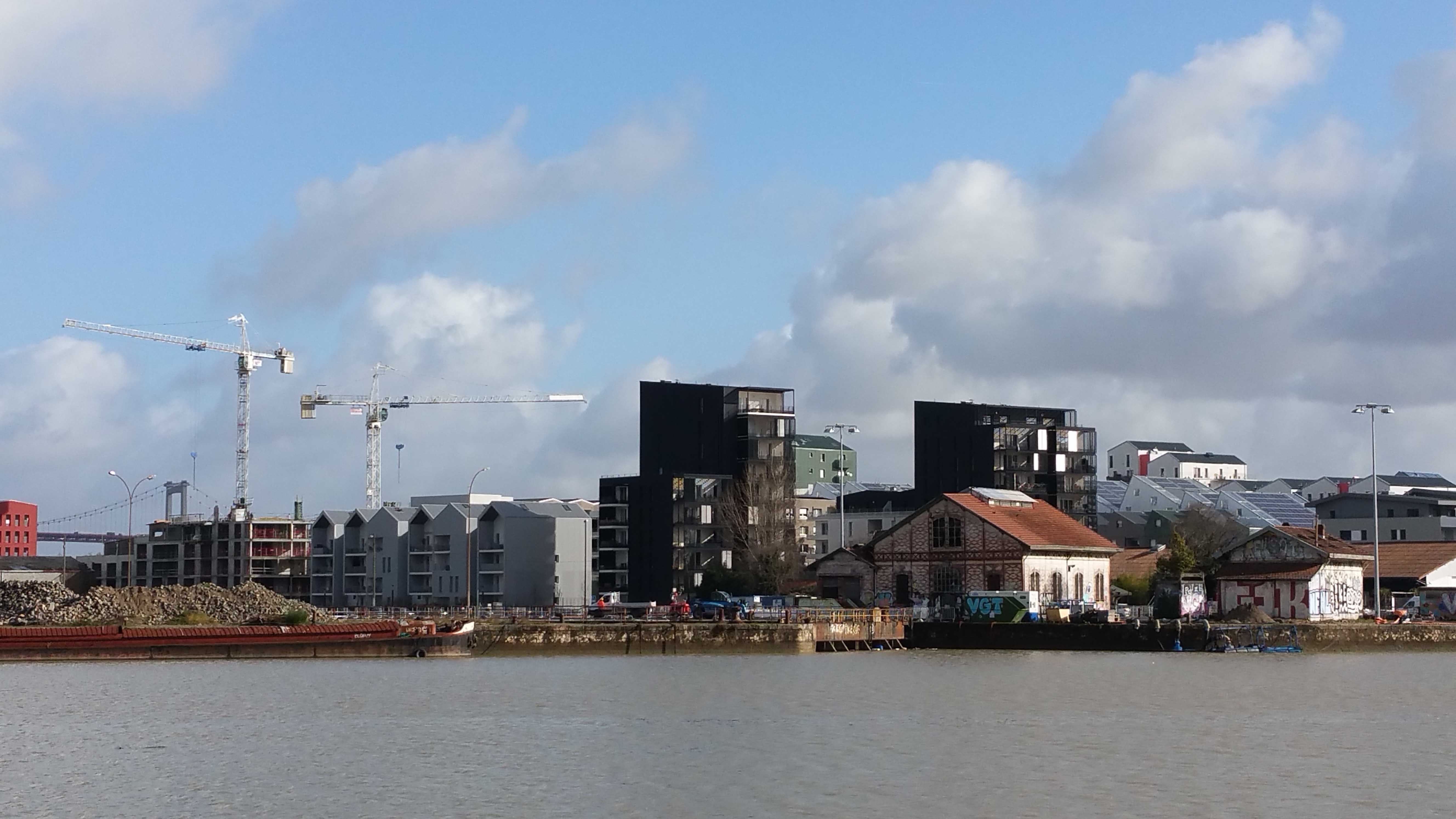
Around the former harbour basins Bassin à flots, a dense urban district is being developed. (Photo: Lisa Diedrich)
Juppé started a comprehensive urban renovation project. He suggested to tackle the territorial dimension in both transversal and transscalar ways. Transversal, as he instated collaboration across municipal departments and professional disciplines to embrace the interrelated urban development issues. Transscalar, as he organized work from large scale concepts to small scale realisations in order to bridge between overarching ideas and material reality. The main instrument of transformation was the installation of a new tramway system, to irrigate the vast metropolitan area, reduce car traffic and air pollution, rebuild the urban open spaces of the city all along the tramway lines, and initiate an ambitious renovation programme for the historic buildings of the city centre.
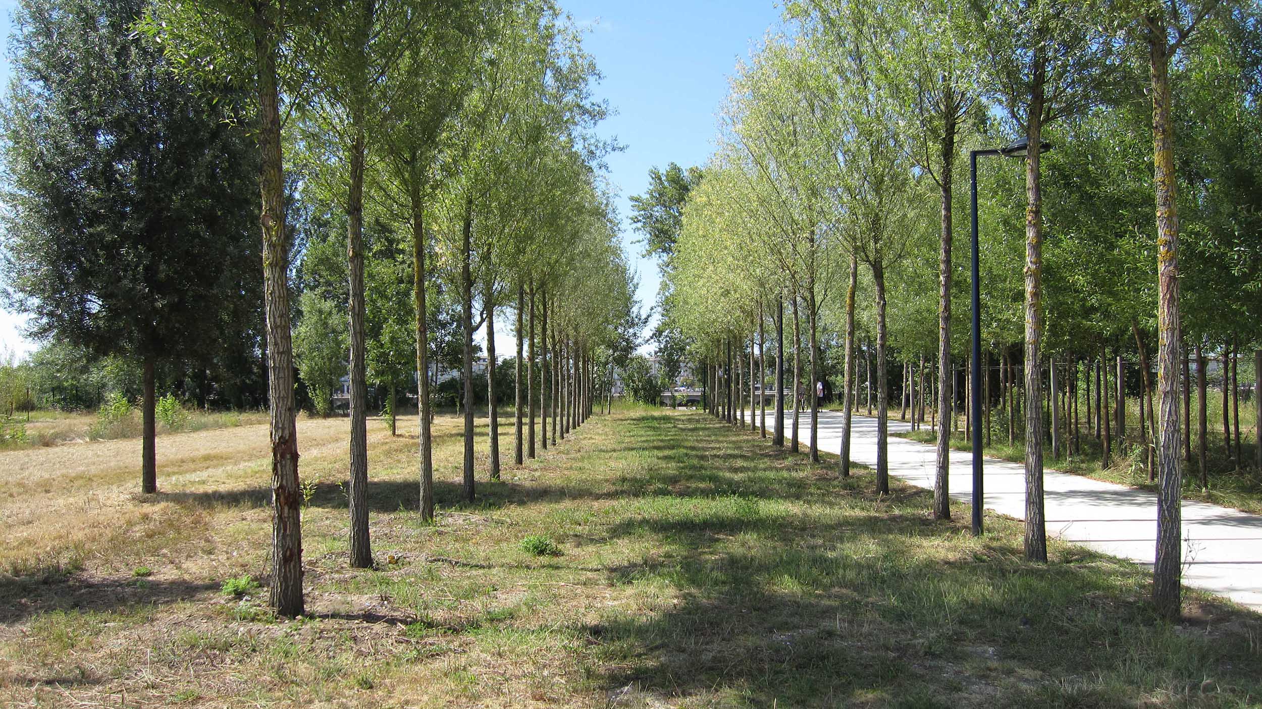
Part of the transformation district La Bastide on the formerly industrial right bank of River Garonne, the Parc aux Angéliques develops in sequences and shows a tree architecture that grows over time, here in the first section. (Photo: Lisa Diedrich)
All efforts started from the city’s main landscape element: River Garonne. On the left bank, the urban fabric of the historic centre and its waterfront were freed from cars, received a 7 kilometre long new pedestrianised quay, and hosted the carefully designed main artery of the new tramway line. On the right bank, a process of transformation set out to turn the run-down industrial areas of La Bastide into vivid mixed-use districts. River Garonne is the spine of the region’s topography, water and green structure, as defined by French landscape architect Michel Desvigne, and it lended the urban transformation project its main spatial guideline. The territorial landscape structure was scaled down into single urban open spaces to accommodate ecological as well as urban functions, and to provide for a different aesthetic characters to both sides of the river, and in the larger surrounds. Over the past decade, the historic left bank has been developed into an elegant urban promenade by French landscape architects Claire et Michel Corajoud, with the Miroir d’Eau, the water mirror, as centre piece. The right bank, in turn, is still under transformation and emerges slowly according to an evolutionary urban open space concept, materialising step by step in the Parc aux Angéliques, designed by Michel Desvigne. Even if the integrative urban development strategy for tramway, building renovation and landscape structure all converge along River Garonne, it also embraces the vast urban territory. At the city’s edges large housing districts of the 1960s currently undergo renovation, such as the Cité Grand Parc with its astonishing architectural renewal by Lacaton Vassal, the old harbour basins of the Bassin à flots are transformed into high-density urban areas, and new eco-districts complete and diversify the formerly monofunctional trade fair and business districts of the Quartier Grand Lac. The French state meanwhile supports the city’s ambition and places it on the European map: A high speed train connection will reduce travel time from Bordeaux to Paris to two hours by the autumn of 2017, with an extension planned to link Bordeaux to Madrid. Around the new Bordeaux main train station (under construction) a state-owned development company directs the conversion of neglected urban plots into the high-end business and multi-use district Euratlantique.
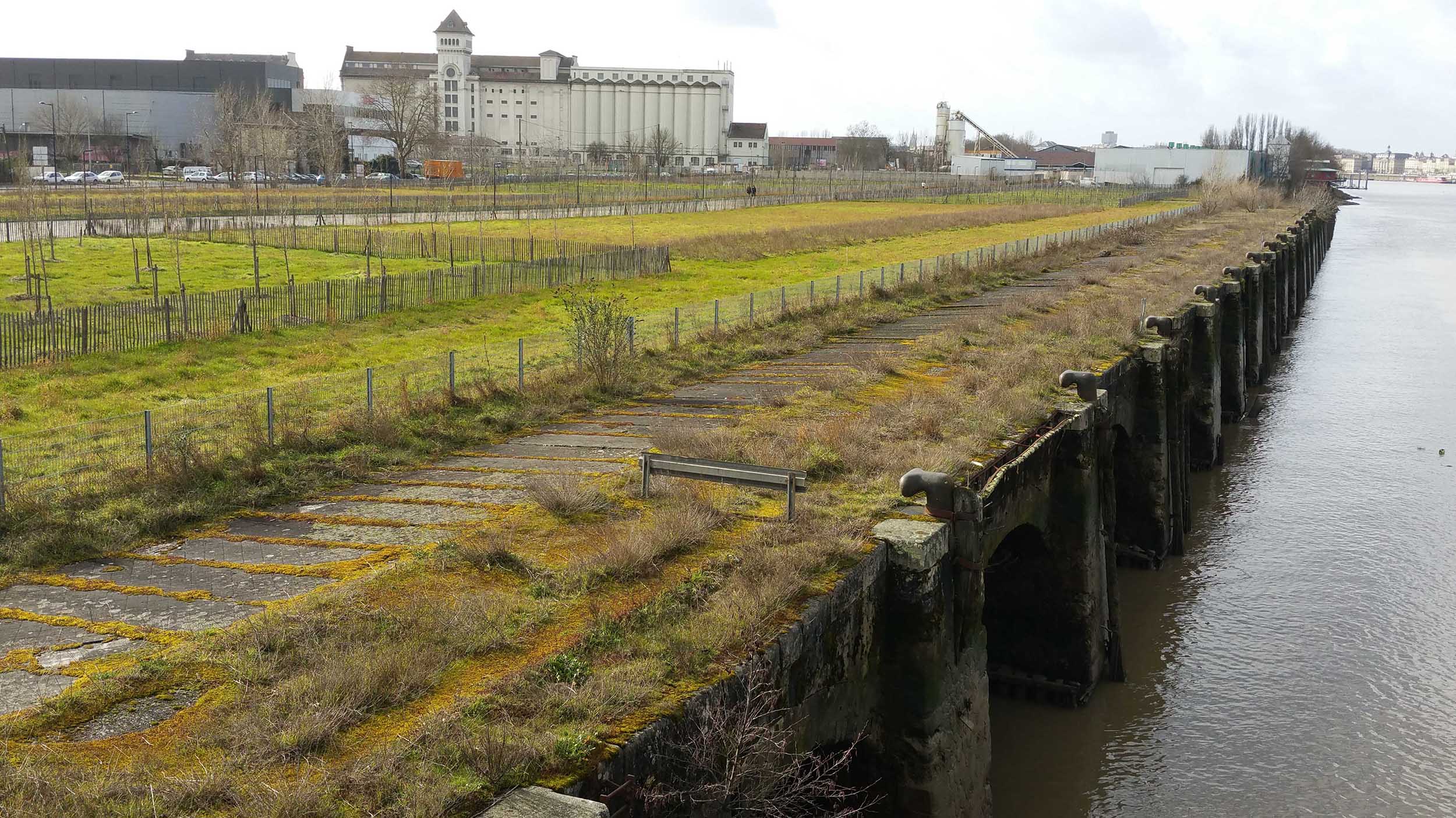
The recently established section of Parc aux Angéliques shows the aesthetics of juvenile tree plantations – ther growth can be experienced over time. (Photo: Lisa Diedrich)
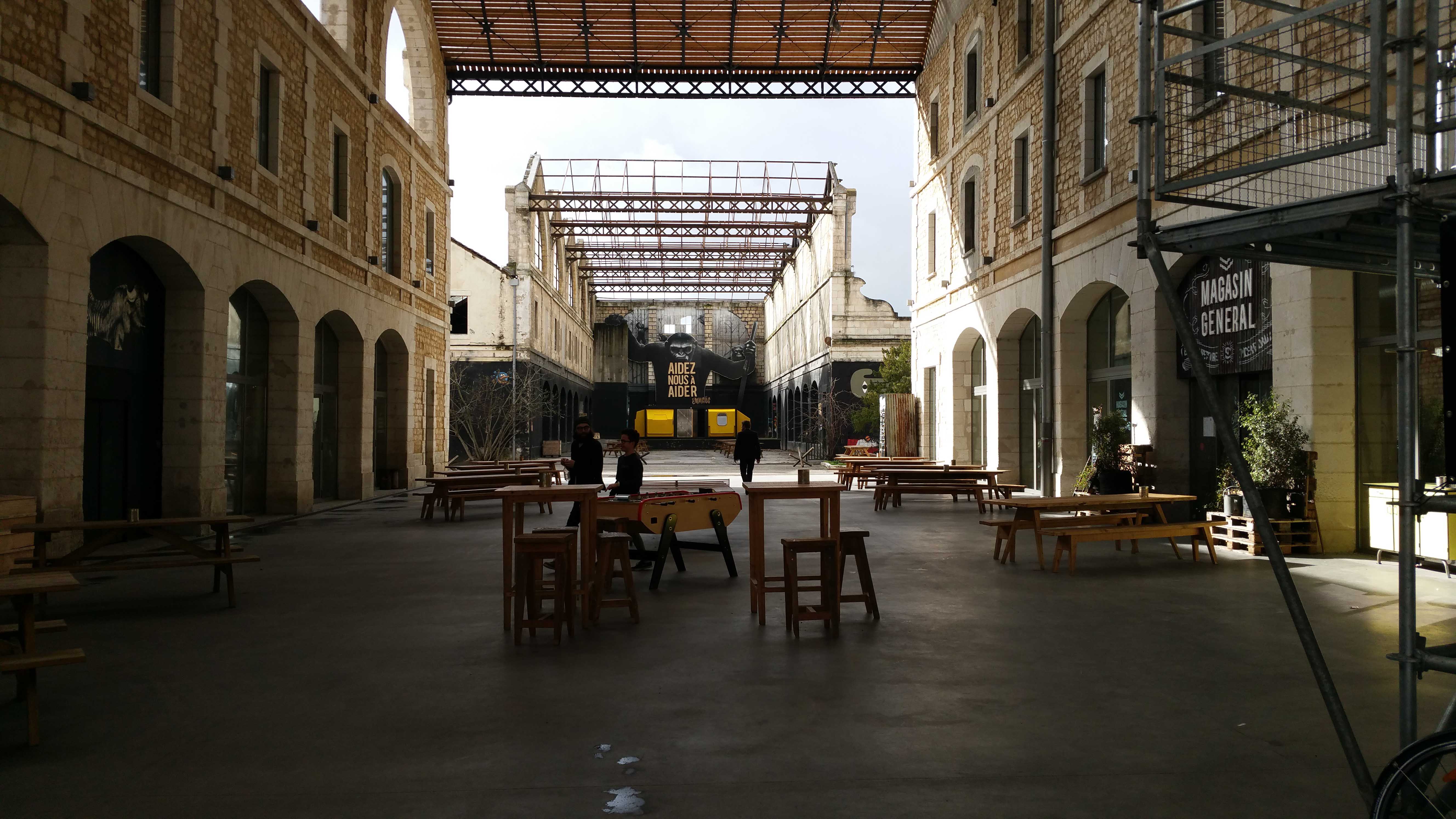
The most innovative landscape architectural transformation however takes shape over years and decades on the former harbour areas of the Right Bank in the Bastide district, where the tree architecture of Parc aux Angéliques first section matures. Close to the historic bridge Pont de Pierre, port industries had freed a large tract of the river bank, and Desvigne completed the existing ripisylvian vegetation on the muddy slip-off slope of the river by rows of trees that take up the straight-lined cadastral geometry of the industrial plots and link over to the street grid of the adjacent transforming districts. Each time a new tract of land is handed over from port to city, the parc grows. To date, small juvenile tree plantations can be seen next to the new Chaban Delmas bridge, to the north of the Bastide district. The middle part will follow at the rhythm of the ongoing transformation, creating a parc in different states of tree development over time, not an ‘finsihed park’ from the very start. The aesthetics of growth resonates with the district’s urban development: piece by piece, industrial plots turn into city – this is not an ‘instant city’. The so-called ‘Darwin Ecosytem’ is currently developing in the old Niel Barracks, to become a hub for business innovation and civic life. Today it is hosting a multitude of start-ups, initiatives and associations in the old buildings, retrofitting them for temporary uses in the first place, to define the longer lasting programme and spatial transformation over time. Just as the Parc aux Angéliques shows is gradual evolution and the growth of trees, Darwin displays emerging uses and the growth of activities.
Main terrace and open air stage host temporary activities at the former Niel Barracks, transforming over time into a hub for start-ups and civic life. (Photo: Lisa Diedrich)
References
https://www.bordeaux.fr/p8351/charte-des-paysages
https://www.bordeaux-metropole.fr/Grands-projets/Grands-projets-urbains
https://www.bordeaux-metropole.fr/Grands-projets/Grands-projets-urbains/Bastide-Niel
Head Image: Part of the left bank promenade on the historic city centre side of River Garonne, the Miroir d’Eau has become a vivid urban open space characterised by a mineral materiality. (Photo: Lisa Diedrich)


