╔
O porto e a sua frente ribeirinha na cidade de Lisboa
O Porto de Lisboa é um dos mais antigos portos da Europa e a sua origem remonta a milhares de anos [1]. A sua existência nasce essencialmente da geografia única do estuário do Tejo. Antes mesmo dos romanos, já povos como os fenícios (por volta do século XII a.C.) utilizavam o estuário do Tejo como abrigo natural para comércio marítimo [2]. Um estuário com excelentes condições naturais: águas calmas, fundo profundo e acesso fácil ao interior do território.
Com a chegada dos romanos, Lisboa (Olisipo) torna-se um porto comercial estruturado, ligado às rotas do Mediterrâneo [3]. O porto romano situava-se essencialmente na atual Baixa Pombalina.
Durante a ocupação muçulmana e depois com a Reconquista, o porto continuou a ser um ponto essencial de comércio e entrada de mercadorias [4].
Durante o século XV e XVI, o Porto de Lisboa torna-se um dos mais importantes do mundo [5], de onde partiam expedições para a África, Índia e Brasil, e se efetuavam carregamentos de especiarias, ouro, outras mercadorias e também escravos. É nesta altura que Lisboa se afirma como capital marítima global.
No século XIX e XX, o porto é modernizado com docas, armazéns, estaleiros e terminais [6].
Hoje, é um porto multifuncional (carga, passageiros, cruzeiros), ainda beneficiando da mesma qualidade geográfica que lhe deu origem há milénios.
The Port of Lisbon is one of the oldest ports in Europe, with origins dating back thousands of years [1]. Its existence is primarily due to the unique geography of the Tagus estuary. Even before the Romans, peoples such as the Phoenicians (around the 12th century BCE) used the Tagus estuary as a natural shelter for maritime trade [2]. The estuary offered excellent natural conditions: calm waters, deep channels, and easy access to the interior of the territory.
With the arrival of the Romans, Lisbon (Olisipo) became a structured commercial port connected to Mediterranean trade routes [3]. The Roman port was mainly located in what is now the Baixa Pombalina.
During the Muslim occupation and later the Reconquista, the port continued to be a crucial hub for trade and the entry of goods [4].
In the 15th and 16th centuries, the Port of Lisbon became one of the most important in the world [5], serving as a departure point for expeditions to Africa, India, and Brazil, and handling shipments of spices, gold, other goods, and slaves. It was during this period that Lisbon established itself as a global maritime capital.
In the 19th and 20th centuries, the port was modernized with docks, warehouses, shipyards, and terminals [6].
Today, it is a multifunctional port (cargo, passengers, cruises), still benefiting from the same geographic advantages that gave rise to it millennia ago.
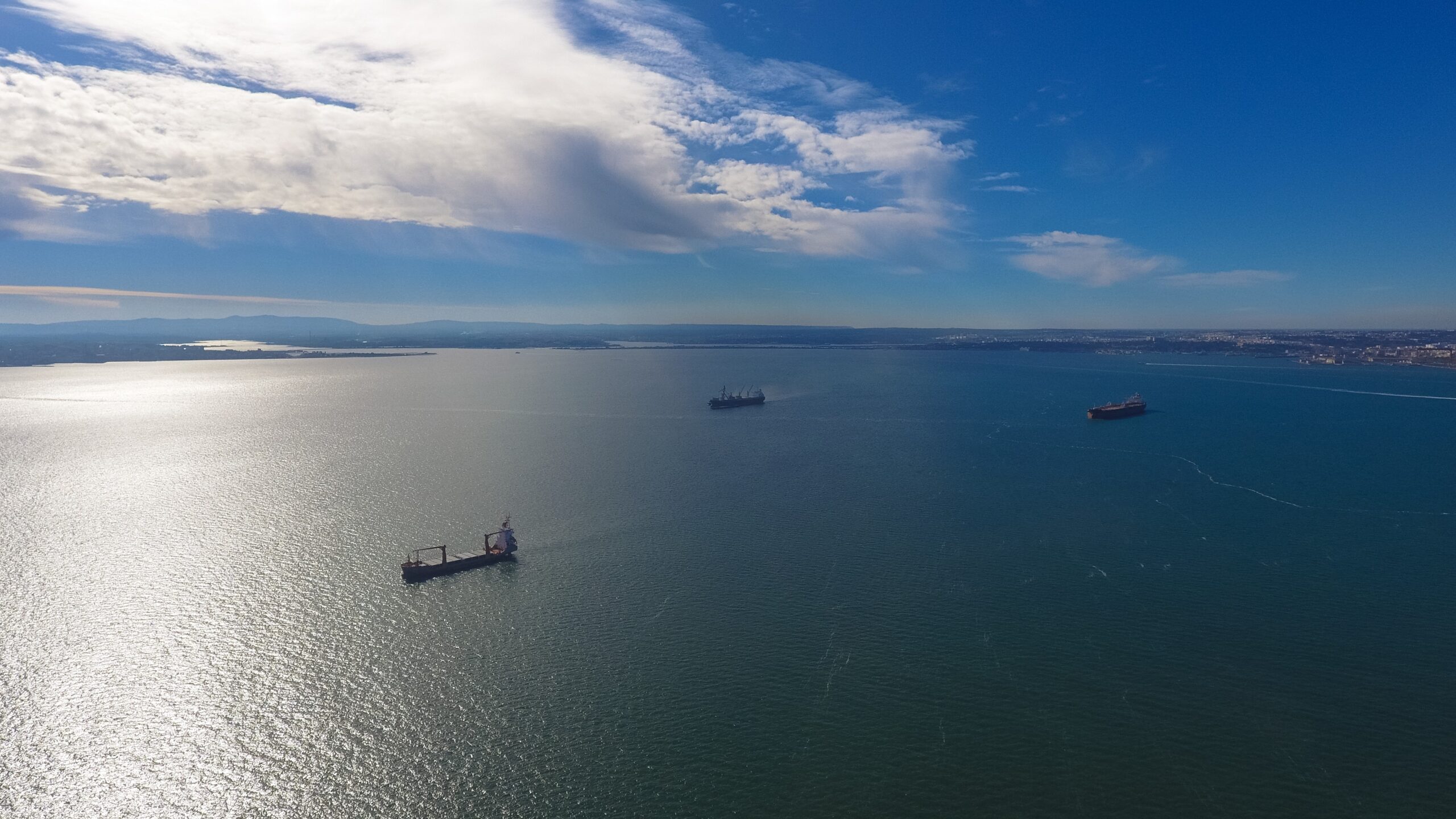
O estuário do Tejo como refúgio natural para o comércio marítimo. (Fonte: Autoridade Portuária de Lisboa).
The Tagus estuary as a natural shelter for maritime trade. (Source: Lisbon Port Authority).
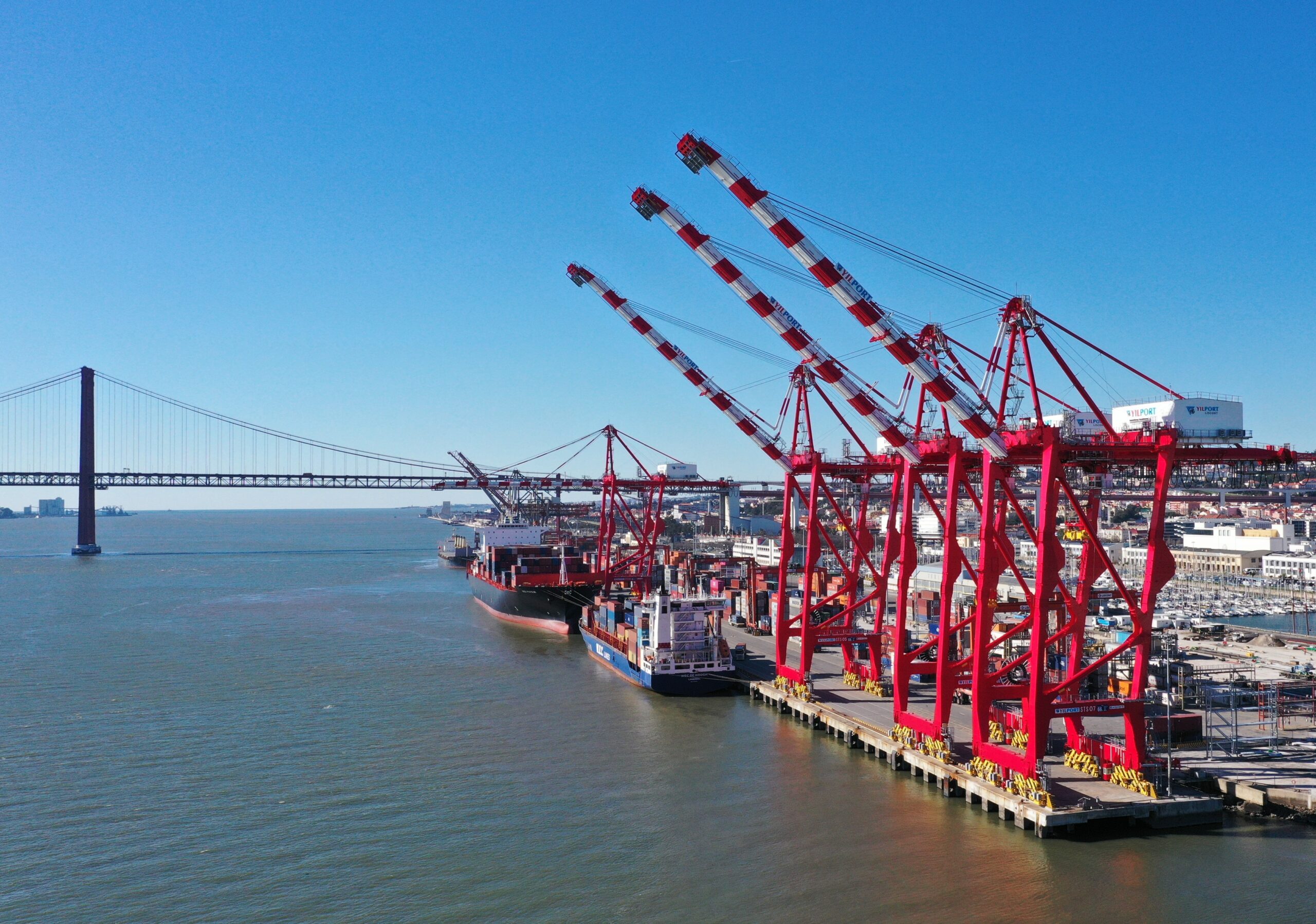
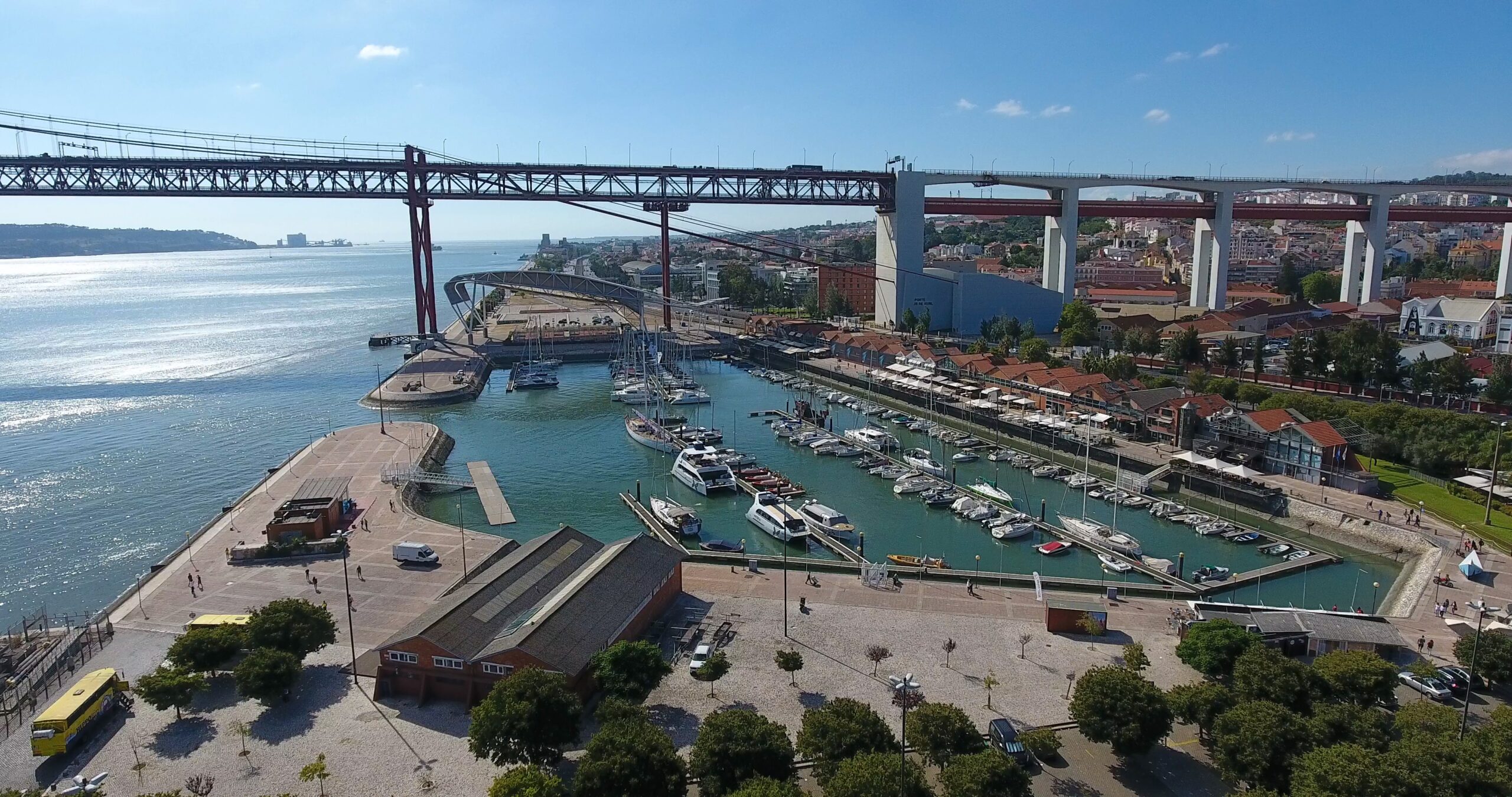
Zona portuária de Alcântara. (Fonte: Autoridade Portuária de Lisboa).
Alcântara port area. (Source: Lisbon Port Authority).
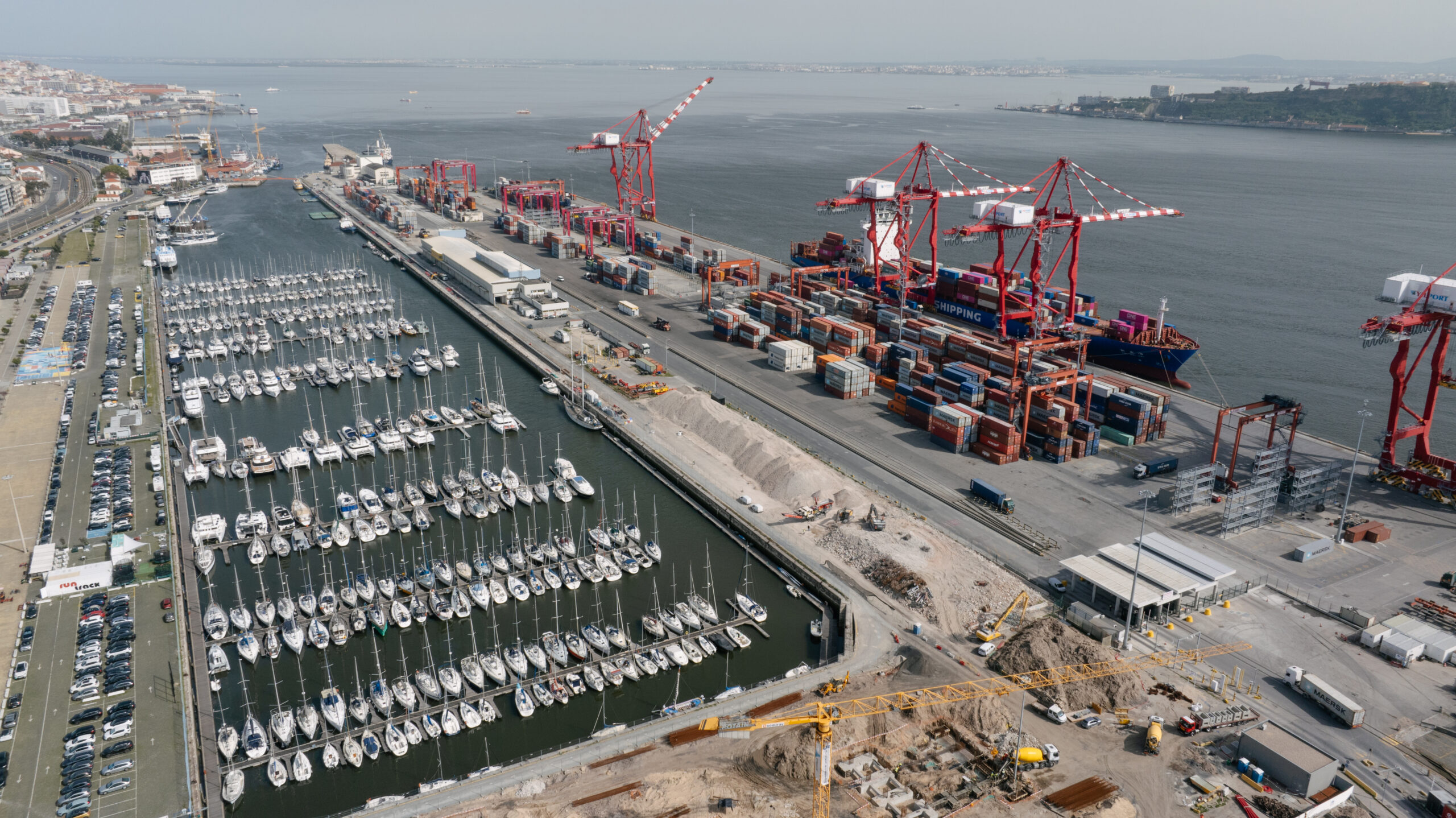
Terminal de contentores de Alcântara. (Fonte: Autoridade Portuária de Lisboa).
Alcântara container terminal. (Source: Lisbon Port Authority).
Terminais de granéis da Trafaria. (Fonte: Autoridade Portuária de Lisboa).
Trafaria bulk terminals. (Source: Lisbon Port Authority).
Sinais de mudança, primeiras experiências e transformação
Signs of Change, Early Experiences, and Transformation
A partir das décadas de 1980 e 1990 observa-se uma inflexão estrutural na relação entre o Porto de Lisboa e a frente ribeirinha [7]. Este período caracteriza-se pelo declínio progressivo das funções industriais e logísticas localizadas em setores centrais da cidade, consequência da modernização dos sistemas portuários [8], da crescente necessidade de áreas de operação de maior escala e da obsolescência de infraestruturas tradicionais. A redução destas atividades gerou vastos territórios subutilizados, desencadeando um processo de reconceptualização urbanística da zona ribeirinha [9].
Paralelamente, surgem as primeiras iniciativas sistemáticas de requalificação urbana com vista à reintegração do Tejo no quotidiano da cidade [10]. A abertura de áreas anteriormente inacessíveis ao público, como a Doca de Santo Amaro, constituiu um marco simbólico e programático deste movimento [11].
A década de 1990 intensifica esta tendência com a decisão de realizar a Expo’98, que funcionou como catalisador para a reconfiguração profunda da zona oriental de Lisboa [12], articulando políticas de desindustrialização, saneamento ambiental e criação de novos modelos de ocupação urbana orientados para o uso público, residencial e terciário.
From the 1980s and 1990s onward, a structural shift can be observed in the relationship between the Port of Lisbon and the waterfront [7]. This period is characterized by the progressive decline of industrial and logistical functions located in central areas of the city, a consequence of the modernization of port systems [8], the growing need for larger-scale operational areas, and the obsolescence of traditional infrastructures. The reduction of these activities generated vast underutilized territories, triggering a process of urban reconceptualization of the waterfront area [9].
At the same time, the first systematic urban regeneration initiatives emerged, aimed at reintegrating the Tagus into the daily life of the city [10]. The opening of areas previously inaccessible to the public, such as the Doca de Santo Amaro, became a symbolic and programmatic milestone of this movement [11].
The 1990s intensified this trend with the decision to host Expo ’98, which acted as a catalyst for the deep reconfiguration of Lisbon’s eastern zone [12], coordinating deindustrialization policies, environmental remediation, and the creation of new urban occupation models oriented toward public, residential, and tertiary use.
Doca de Santo Amaro. (Fonte: Autoridade Portuária de Lisboa).
Doca de Santo Amaro. (Source: Lisbon Port Authority).
Simultaneamente, inicia-se um debate institucional e académico em torno da redefinição das fronteiras entre porto e cidade [13], procurando compatibilizar as exigências operacionais contemporâneas do setor portuário com a valorização paisagística e social da frente de água. As intervenções deste período consolidaram os princípios que, nas décadas subsequentes, permitiram a progressiva transformação do litoral urbano de Lisboa num espaço de coexistência entre funções portuárias especializadas e programas urbanos de elevada intensidade simbólica e cultural.
Simultaneously, an institutional and academic debate began regarding the redefinition of the boundaries between port and city [13], seeking to reconcile the contemporary operational demands of the port sector with the landscape and social valorization of the waterfront. The interventions of this period consolidated principles that, in subsequent decades, allowed the progressive transformation of Lisbon’s urban shoreline into a space of coexistence between specialized port functions and urban programs with high symbolic and cultural intensity.
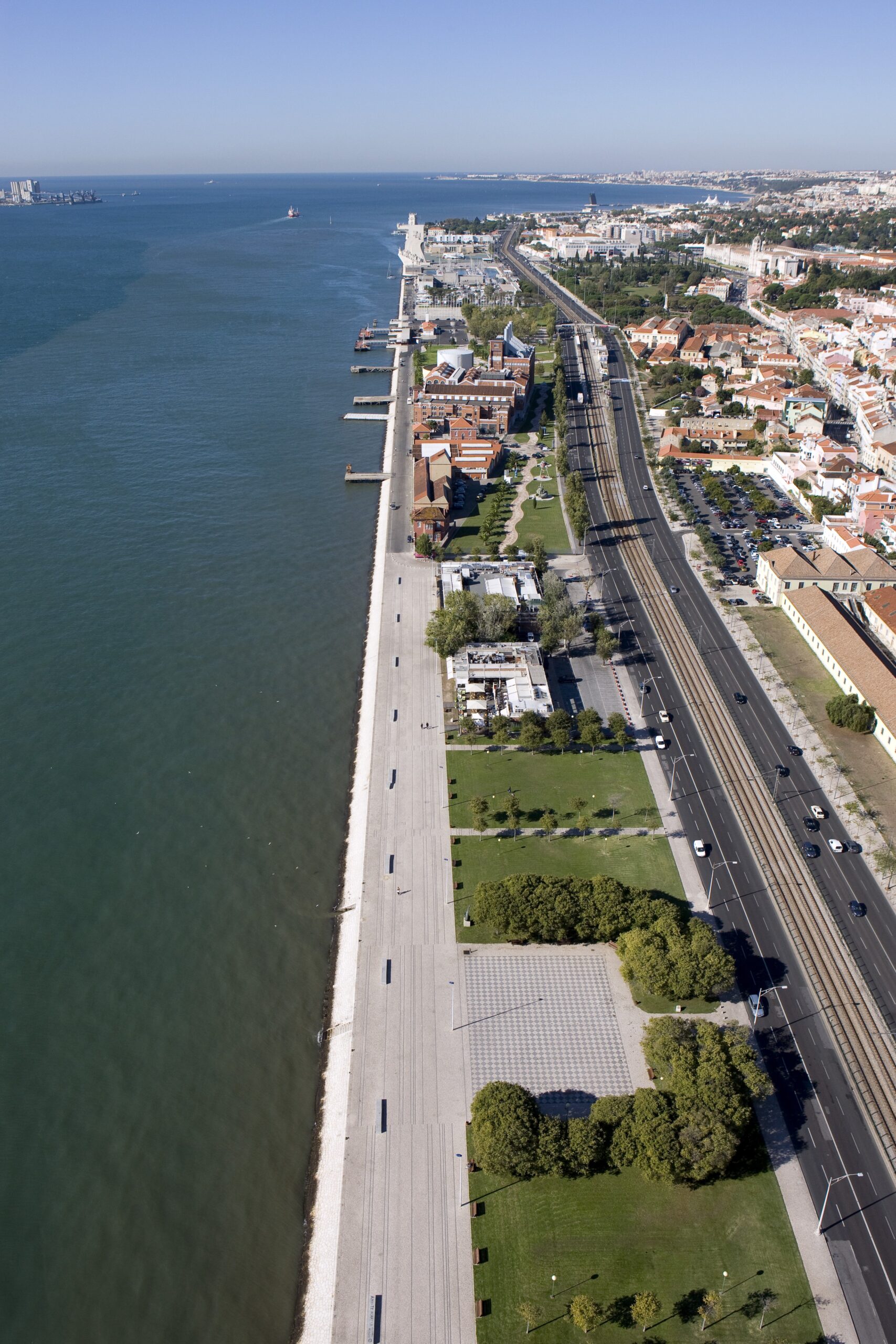
Reurbanização da frente ribeirinha de Lisboa entre os bairros históricos de Belém e Alcântara, concretamente da zona da Junqueira junto ao rio Tejo. (Fonte: Autoridade Portuária de Lisboa).
Reurbanization of the Lisbon waterfront between the historic districts of Belém and Alcântara, specifically from the Junqueira area to the banks of the Tagus River. (Source: Lisbon Port Authority).
Surpresas
Surprises
A transformação da frente ribeirinha de Lisboa revelou um conjunto de surpresas — efeitos inesperados, resultados não previstos nos documentos estratégicos iniciais e consequências emergentes das dinâmicas urbano-portuárias [14]. Estas surpresas tornam-se fundamentais para compreender a especificidade do caso de Lisboa, distinguindo-o de outras regenerações europeias. O processo lisboeta caracterizou-se por um ritmo irregular, por negociações complexas e por uma forte influência de fatores externos, como a globalização portuária ou a realização da Expo’98.
Nos primeiros diagnósticos realizados na zona oriental, verificou-se que a contaminação industrial era muito mais grave do que se imaginava [15]. Solos e aquíferos estavam profundamente afetados por décadas de atividade petroquímica, metalúrgica e de moagens. Esta descoberta representou uma surpresa substancial, pois obrigou à integração de técnicas sofisticadas de descontaminação [16], à redefinição de prazos e ao aumento significativo dos investimentos públicos. A profundidade da contaminação não só atrasou o processo de requalificação, como também se tornou o maior desafio técnico da operação.
The transformation of Lisbon’s waterfront revealed a set of surprises—unexpected effects, results not anticipated in the initial strategic documents, and emergent consequences of urban-port dynamics [14]. These surprises are fundamental for understanding the specificity of Lisbon’s case, distinguishing it from other European regenerations. The Lisbon process was characterized by an irregular pace, complex negotiations, and a strong influence from external factors, such as port globalization or Expo ’98.
Early assessments in the eastern zone revealed that industrial contamination was far more severe than expected [15]. Soil and aquifers were deeply affected by decades of petrochemical, metallurgical, and milling activities. This finding represented a substantial surprise, requiring the integration of advanced decontamination techniques [16], the redefinition of timelines, and a significant increase in public investment. The depth of contamination not only delayed the redevelopment process but also became the operation’s main technical challenge.
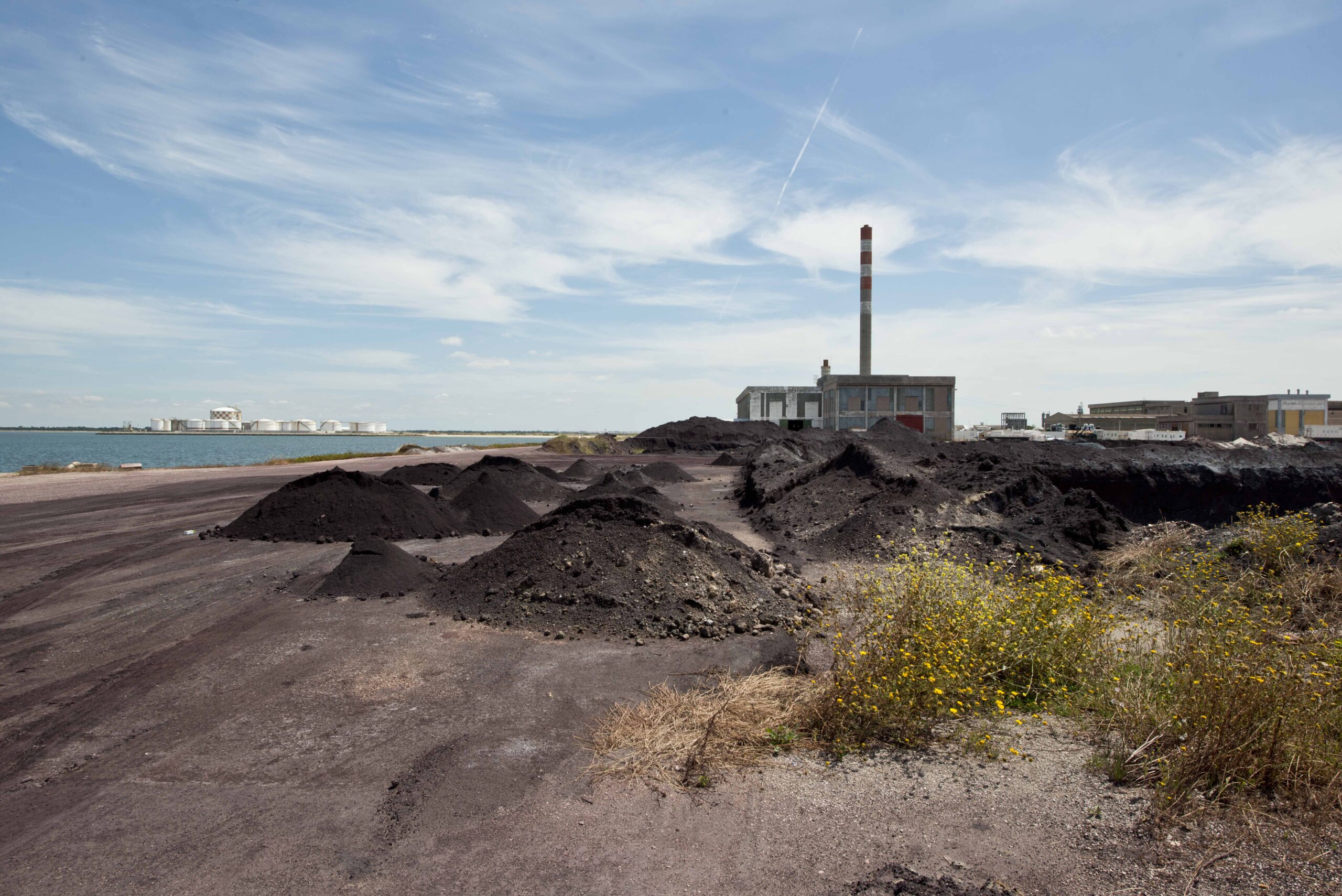
O processo de descontaminação do polo industrial do Barreiro. (Fonte: Autoridade Portuária de Lisboa; © Luísa Ferreira).
The decontamination process of the Barreiro industrial area. (Source: Lisbon Port Authority; © Luísa Ferreira).
À medida que fábricas, armazéns e equipamentos industriais cessavam atividade, surgia uma contínua extensão de território devoluto ao longo do Tejo [17]. Inicialmente vistos como espaços marginais, estes terrenos revelaram-se uma reserva estratégica de solo, com uma extensão e continuidade espacial muito superiores ao previsto. A disponibilidade territorial contribuiu para uma visão sistémica da frente ribeirinha: não apenas como uma sucessão de projetos isolados, mas como um corredor urbano contínuo capaz de redefinir a estrutura metropolitana.
Os primeiros projetos-piloto — nomeadamente as Docas de Santo Amaro e as zonas pedonais entre o Cais do Sodré e Belém — demonstraram que havia uma procura social reprimida pelo acesso ao Tejo [18]. A população apropriou-se dos novos espaços com uma intensidade surpreendente, acelerando a pressão para continuar a requalificação. Esta apropriação espontânea revelou o papel do rio como elemento estruturante da identidade urbana, contrariando décadas de afastamento físico e simbólico.
As factories, warehouses, and industrial facilities ceased operations, a continuous stretch of vacant land emerged along the Tagus [17]. Initially regarded as marginal spaces, these areas proved to be a strategic land reserve, with much greater spatial extent and continuity than anticipated. Territorial availability contributed to a systemic vision of the waterfront: not merely a succession of isolated projects, but a continuous urban corridor capable of redefining metropolitan structure.
Early pilot projects —namely the Doca de Santo Amaro and pedestrian areas between Cais do Sodré and Belém— demonstrated a previously suppressed social demand for access to the Tagus [18]. The population appropriated these new spaces with surprising intensity, accelerating pressure to continue redevelopment. This spontaneous appropriation revealed the river’s role as a structuring element of urban identity, countering decades of physical and symbolic separation.
Corredor urbano contínuo da frente costeira. (Fonte: Autoridade Portuária de Lisboa).
Continuous urban corridor of the waterfront. (Source: Lisbon Port Authority).
Embora se reconhecesse que seriam necessárias negociações, não se antecipou a dimensão dos conflitos entre a Câmara Municipal de Lisboa e a Administração do Porto de Lisboa [19]. A disputa não se limitou à definição de usos do solo, mas estendeu-se ao plano político, económico e simbólico. A controvérsia sobre que funções deveriam permanecer portuárias e quais seriam reconvertidas num contexto urbano gerou tensões prolongadas, exigindo soluções inovadoras de governança.
Um dos acontecimentos mais surpreendentes foi a evolução da Expo’98 de simples exposição internacional para um processo de transformação territorial sem precedentes [20]. A escala da intervenção — descontaminação, infraestruturas, mobilidade, equipamentos culturais, espaço público — superou todas as expectativas. A Expo tornou-se o elemento unificador de uma estratégia mais ampla de reconfiguração da zona oriental, funcionando como motor de investimentos e legitimação política.
A atuação da Parque Expo introduziu metodologias de gestão mais flexíveis, interdisciplinares e orientadas para resultados [21], contrastando com a tradição administrativa portuguesa. Esta forma de gestão de projeto constituiu uma surpresa institucional, apresentando-se como alternativa à estrutura municipal e à gestão portuária tradicional. O modelo teve impacto na coordenação interinstitucional e tornou-se referência para intervenções futuras.
Durante grande parte do século XX, o Tejo existia como espaço funcional, industrial e portuário. A partir das primeiras intervenções, esta perceção mudou rapidamente: o rio passou a ser visto como paisagem e espaço de lazer [22]. Esta mudança simbólica não estava prevista nos programas iniciais, mas foi determinante para consolidar a aceitação pública e política da requalificação.
A requalificação trouxe novos padrões de mobilidade suave (ciclistas, corredores, peões) [23], atraindo grupos populacionais diversificados. Áreas antes pouco frequentadas tornaram-se espaços de sociabilidade, com forte dinamismo cultural, turístico e noturno. Esta transformação surpreendeu pelo seu ritmo e intensidade, exigindo novas formas de planeamento do espaço público.
Although negotiations were expected, the scale of conflicts between the Lisbon City Council and the Port of Lisbon Authority was unforeseen [19]. The dispute extended beyond land-use definitions to political, economic, and symbolic dimensions. Controversy over which functions should remain port-related, and which could be converted for urban use generated prolonged tensions, requiring innovative governance solutions.
One of the most surprising developments was the evolution of Expo ’98 from a simple international exhibition to an unprecedented territorial transformation [20]. The scale of intervention—including decontamination, infrastructure, mobility, cultural facilities, and public space exceeded all expectations. Expo became the unifying element of a broader strategy for reconfiguring the eastern zone, serving as a driver of investment and political legitimacy.
Parque Expo’s management introduced more flexible, interdisciplinary, and results-oriented methodologies [21], contrasting with traditional Portuguese administration. This project management approach constituted an institutional surprise, presenting an alternative to municipal structures and traditional port management. The model impacted interinstitutional coordination and became a reference for future interventions.
For much of the 20th century, the Tagus existed primarily as a functional, industrial, and port space. From the first interventions onward, this perception changed rapidly: the river began to be seen as a landscape and leisure space [22]. This symbolic shift was not anticipated in initial programs but was crucial for consolidating public and political acceptance of the redevelopment.
Redevelopment introduced new patterns of soft mobility (cyclists, corridors, pedestrians) [23], attracting diverse population groups. Previously underused areas became social spaces with strong cultural, touristic, and nightlife dynamics. This transformation surprised observers with its pace and intensity, requiring new forms of public-space planning.
A Ribeira das Naus, o espaço público mais emblemático da frente ribeirinha de Lisboa. (Fonte: Autoridade Portuária de Lisboa).
La Ribeira das Naus, the most emblematic public space of the Lisbon promenade. (Source: Lisbon Port Authority).
A Ribeira das Naus, durante séculos o principal estaleiro de Lisboa, é hoje um espaço de lazer e convívio equipado com uma ‘praia’ urbana artificial, onde residentes e turistas podem admirar a paisagem. (Fonte: Autoridade Portuária de Lisboa).
Ribeira das Naus, for centuries Lisbon’s main shipyard, is now a place for relaxation and socializing, equipped with an artificial urban “beach” where residents and tourists can admire the panorama. (Source: Lisbon Port Authority).
Armazéns, silos e gruas, antes vistos como ruínas de um passado obsoleto, passaram a ser reinterpretados como elementos identitários da frente ribeirinha [24]. A integração destes elementos no desenho urbano constituiu uma transformação cultural significativa, inesperada nos planos iniciais.
As intervenções ribeirinhas geraram uma valorização imobiliária muito mais rápida e intensa do que se estimava [25]. Este fenómeno atraiu investimento privado, acelerou a transformação urbanística e gerou efeitos multiplicadores sobre comércio, turismo e serviços. No entanto, também levantou questões sobre gentrificação e desigualdade no acesso à habitação.
A requalificação da zona oriental e a construção do Parque das Nações alteraram profundamente o modelo territorial de Lisboa [26], que deixou de se organizar exclusivamente sobre a frente ocidental e sobre o centro histórico. A emergência de novas centralidades constituiu uma surpresa estrutural, transformando a própria geografia funcional da cidade.
Contrariamente ao que muitos previam, a modernização portuária permitiu ao Porto de Lisboa manter relevância estratégica [27], adaptando-se à nova relação com a cidade. A reorganização das áreas operacionais e a especialização em novos setores mostraram uma capacidade de reinvenção que muitos estudos iniciais não anteciparam.
Warehouses, silos, and cranes, previously seen as ruins of an obsolete past, were reinterpreted as identity elements of the waterfront [24]. Integrating these elements into urban design represented a significant cultural transformation, unforeseen in the initial plans.
Waterfront interventions generated much faster and more intense real-estate valorization than anticipated [25]. This phenomenon attracted private investment, accelerated urban transformation, and produced multiplier effects on commerce, tourism, and services. However, it also raised concerns about gentrification and unequal access to housing.
Redevelopment of the eastern zone and the construction of Parque das Nações profoundly altered Lisbon’s territorial model [26], which ceased to be organized exclusively around the western waterfront and historic center. The emergence of new centralities constituted a structural surprise, transforming the city’s functional geography.
Contrary to many predictions, port modernization allowed the Port of Lisbon to maintain strategic relevance [27], adapting to the new relationship with the city. Reorganization of operational areas and specialization in new sectors demonstrated a capacity for reinvention that many early studies had not anticipated.
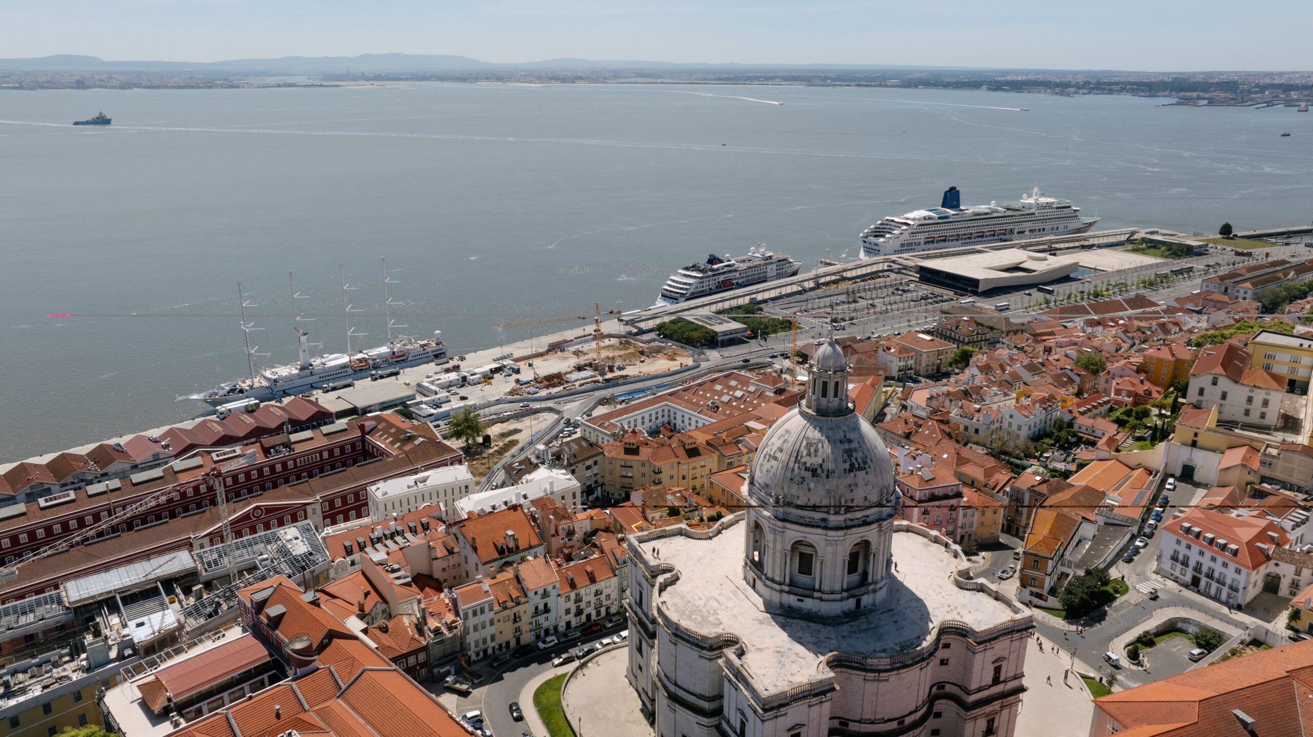
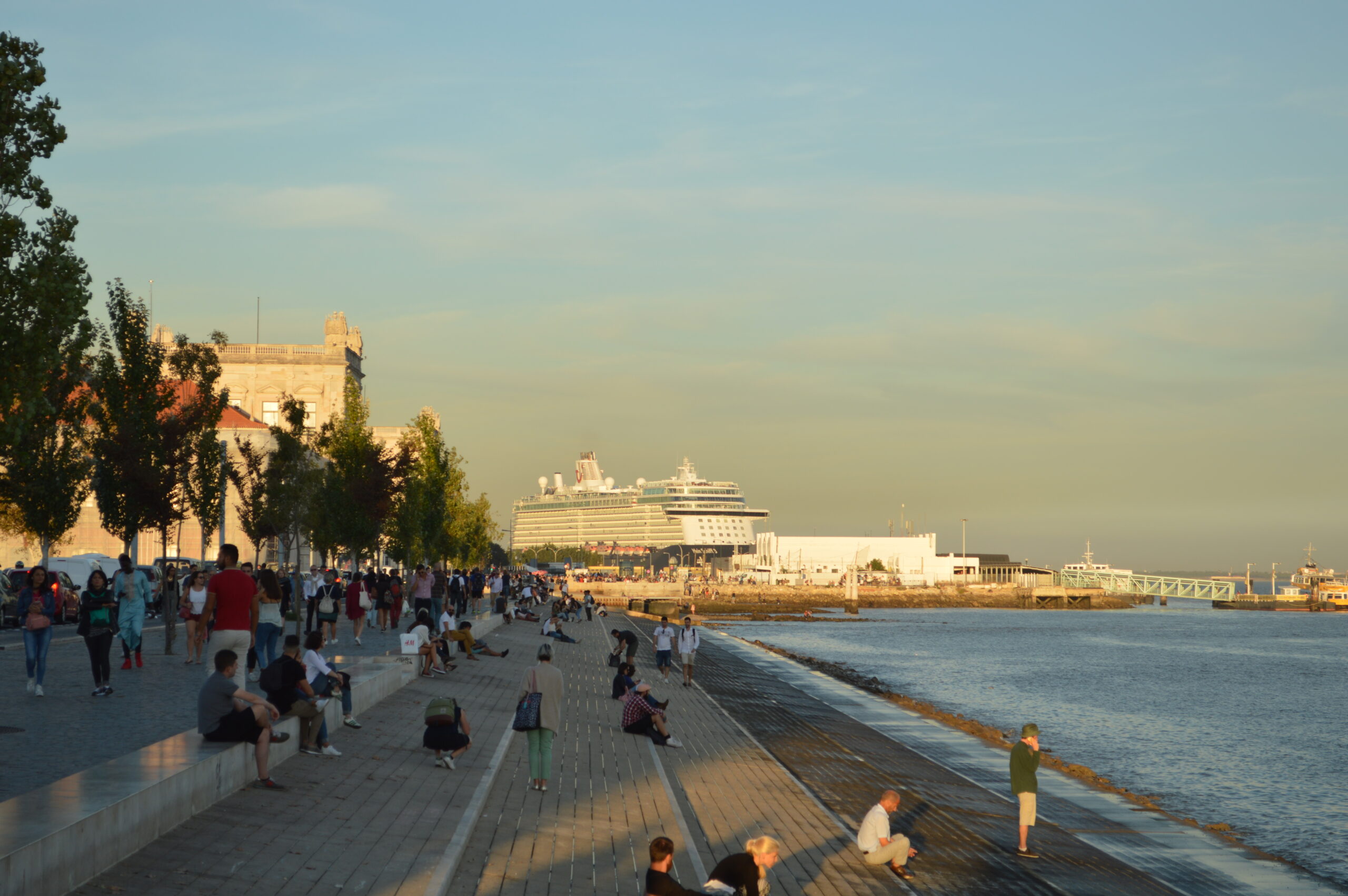
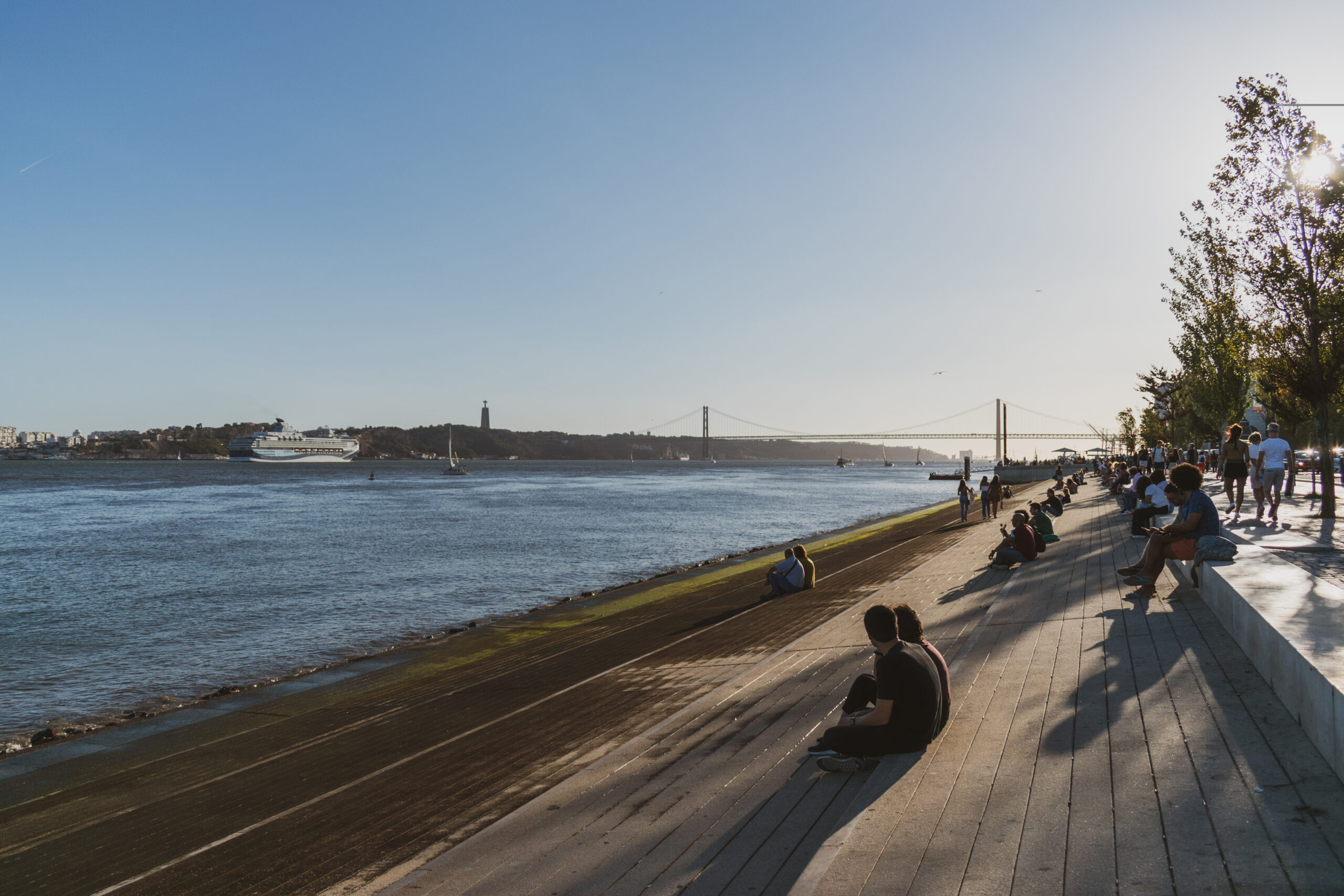
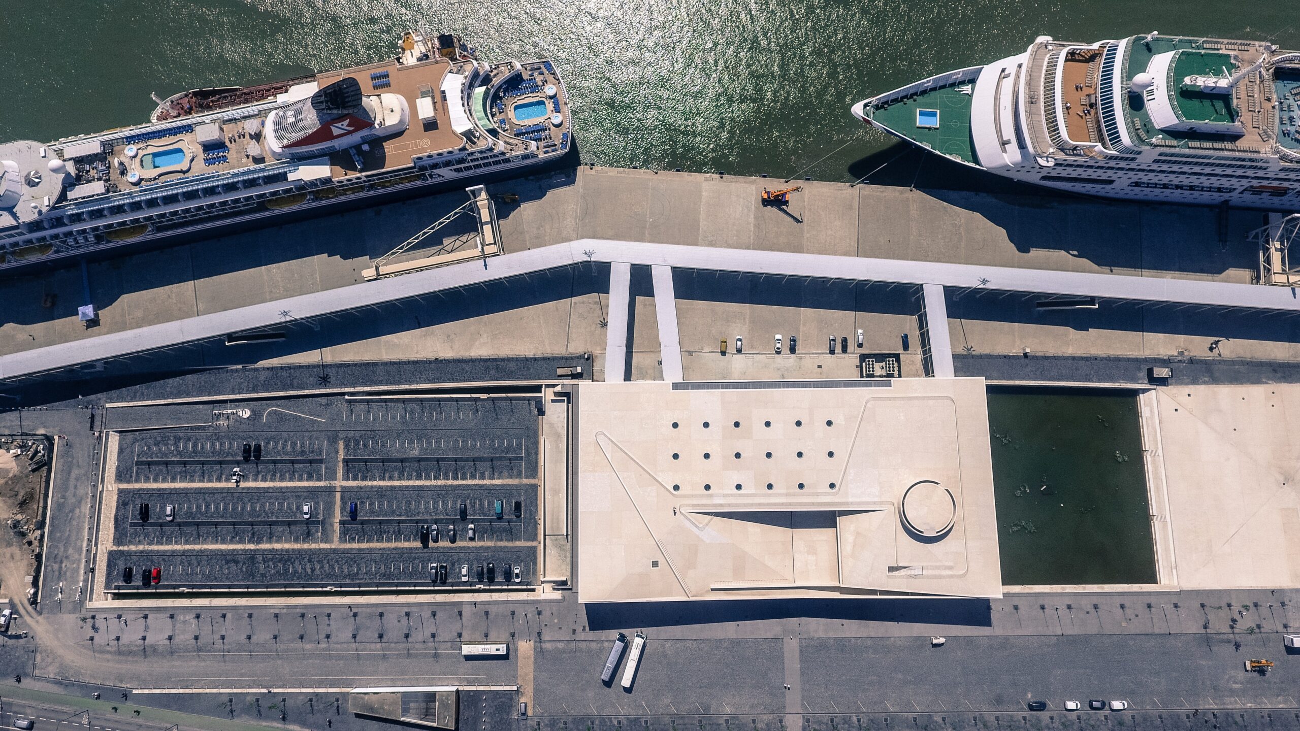
Imagens do Terminal de Cruzeiros de Lisboa, uma infraestrutura moderna e estratégica que liga o coração histórico da capital portuguesa às rotas marítimas globais, reforçando a vocação turística da cidade. (Fonte: Autoridade Portuária de Lisboa).
Images of the Lisbon Cruise Terminal, a modern and strategic infrastructure that connects the historic heart of the Portuguese capital with global maritime routes, strengthening the city’s tourist vocation. (Source: Lisbon Port Authority).
As surpresas ocorridas durante a transformação da frente ribeirinha de Lisboa ilustram a natureza complexa, dinâmica e contingente dos processos urbanísticos. Revelam que as cidades são sistemas abertos, influenciados por fatores institucionais, económicos, sociais e simbólicos que ultrapassam a planificação formal [28]. A compreensão destes imprevistos permite interpretar a regeneração ribeirinha não como um processo linear, mas como uma construção negociada e continuamente adaptada.
The surprises occurring during the transformation of Lisbon’s waterfront illustrate the complex, dynamic, and contingent nature of urban processes. They reveal that cities are open systems influenced by institutional, economic, social, and symbolic factors that go beyond formal planning [28]. Understanding these unforeseen events allows waterfront regeneration to be interpreted not as a linear process but as a negotiated and continuously adapted construction.
E a seguir?
Evoluções Futuras da Frente Ribeirinha de Lisboa: Cenários, Tendências e Potenciais Transformações
What Next?
Future Developments of Lisbon’s Waterfront: Scenarios, Trends, and Potential Transformations
O futuro da frente ribeirinha de Lisboa depende da articulação entre dinâmicas urbanas, portuárias, ambientais, tecnológicas e sociais [29]. A transformação ocorrida desde os anos 80 revelou a capacidade da cidade de se reinventar perante mudanças globais — desindustrialização, novas políticas urbanas, reestruturação portuária e evolução dos modelos de mobilidade. Contudo, a frente ribeirinha permanece um território em aberto, onde coexistem tensões, oportunidades e incertezas.
Este capítulo propõe uma análise prospetiva, identificando tendências estruturais, cenários possíveis e linhas de evolução que poderão orientar o desenvolvimento futuro da relação entre Lisboa, o Tejo e o porto.
Uma das evoluções mais prováveis é a criação de um corredor contínuo de espaço público ao longo de toda a margem entre Algés e o Parque das Nações [30]. Hoje, a frente ribeirinha existe em trechos descontínuos, interrompidos por usos portuários, vias rápidas ou áreas ferroviárias. A futura reconfiguração destas barreiras permitirá: uma ligação pedonal e ciclável uniforme; a integração com a área portuária; a criação de parques lineares e novos espaços de lazer; uma maior coesão urbana e ambiental ao longo do Tejo.
As transformações globais da mobilidade apontam para a redução progressiva do automóvel nas zonas centrais [31]. Assim, a frente ribeirinha poderá evoluir para um espaço onde: os transportes públicos (autocarros elétricos, metro, shuttles autónomos) ganhem prioridade; haja ciclovias contínuas e seguras; espaços pedonais se sobreponham a lógicas rodoviárias; novos modos de transporte fluvial contribuam para a mobilidade metropolitana.
A subida prevista do nível médio das águas e o aumento da frequência de eventos extremos exigirão estratégias de resiliência climática [32]. A futura intervenção ribeirinha poderá incluir: sistemas híbridos de defesa costeira (barreiras naturais + infraestruturas discretas); zonas de amortecimento inundável (parques que se adaptam a cheias); renaturalização de margens para dissipação de energia das marés; soluções urbanas baseadas na natureza (nature-based solutions).
O Tejo poderá ser entendido não apenas como paisagem ou recurso económico, mas como infraestrutura ambiental [33] capaz de: regular microclimas; suportar biodiversidade ripícola; integrar sistemas de drenagem sustentável; criar corredores ecológicos ligados ao interior da cidade.
As pressões ambientais e a evolução tecnológica apontam para um porto mais compacto, inteligente e limpo [34]. Potenciais evoluções incluem: tecnologia automatizada na movimentação de carga; eletrificação total dos terminais; redução drástica de emissões; reorganização das áreas portuárias para maior eficiência espacial.
As áreas portuárias poderão gradualmente libertar espaço urbano [35] à medida que a logística se torna mais especializada. Ao mesmo tempo, zonas tradicionais poderão ser reconvertidas para usos mistos, preservando atividades marítimas e integrando funções culturais ou de lazer. Isto poderá conduzir a: novos bairros ribeirinhos construídos sobre infraestruturas híbridas; musealização inteligente do património industrial-portuário; criação de “ilhas logísticas” discretas e altamente tecnificadas.
The future of Lisbon’s waterfront depends on the interaction between urban, port, environmental, technological, and social dynamics [29]. Transformations since the 1980s have revealed the city’s capacity to reinvent itself in response to global changes, deindustrialization, new urban policies, port restructuring, and evolving mobility models. Nevertheless, the waterfront remains an open territory, where tensions, opportunities, and uncertainties coexist.
This chapter offers a prospective analysis, identifying structural trends, possible scenarios, and evolutionary pathways that may guide the future development of the relationship between Lisbon, the Tagus, and the port.
One of the most likely developments is the creation of a continuous public-space corridor along the entire riverbank between Algés and Parque das Nações [30]. Today, the waterfront exists in discontinuous segments, interrupted by port uses, highways, or railway zones. Reconfiguring these barriers would enable a uniform pedestrian and cycling connection; integration with the port; creation of linear parks and new leisure spaces; and greater urban and environmental cohesion along the Tagus.
Global mobility transformations point to a gradual reduction of cars in central areas [31]. Accordingly, the waterfront could evolve into a space where public transport (electric buses, metro, autonomous shuttles) takes priority; continuous and safe bike lanes exist; pedestrian spaces override road logic; and new waterborne transport modes contribute to metropolitan mobility.
Projected sea-level rise and increased frequency of extreme events will require climate-resilience strategies [32]. Future waterfront interventions could include hybrid coastal defense systems (natural barriers plus discreet infrastructure); flood-adaptable buffer zones (parks that accommodate rising waters); riparian renaturalization to dissipate tidal energy; and nature-based urban solutions.
The Tagus could be understood not only as a landscape or economic resource but as an environmental infrastructure [33] capable of regulating microclimates, supporting riparian biodiversity, integrating sustainable drainage systems, and creating ecological corridors connected to the city interior.
Environmental pressures and technological evolution point to a more compact, intelligent, and clean port [34]. Potential developments include automated cargo handling, full terminal electrification, drastic emission reductions, and reorganization of port areas for greater spatial efficiency.
Port areas could gradually release urban space [35] as logistics become more specialized. Simultaneously, traditional zones could be converted to mixed uses, preserving maritime activities while integrating cultural or leisure functions. This could lead to new waterfront neighborhoods built over hybrid infrastructures, intelligent musealization of industrial-port heritage, and creation of discreet, highly technological “logistics islands.”
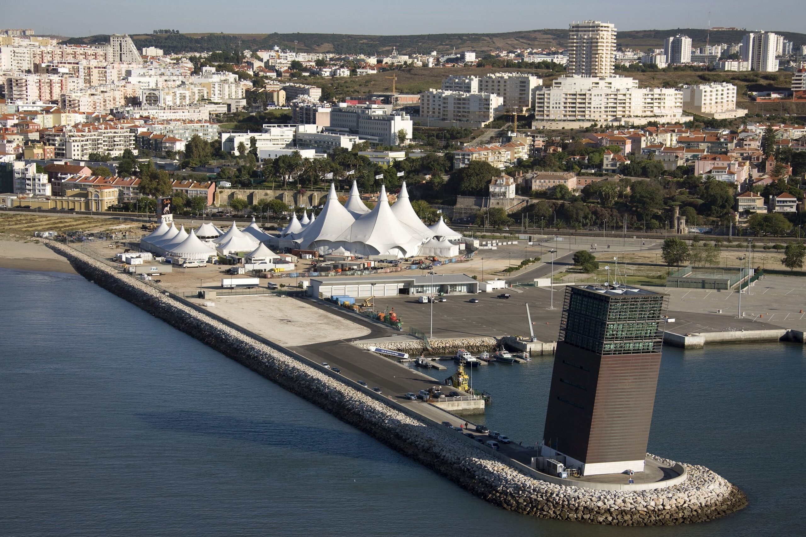
O edifício do Vessel Traffic System na zona portuária de Algés, um polo dinâmico com espaços flexíveis para a cultura e grandes eventos. (Fonte: Autoridade Portuária de Lisboa).
The Vessel Traffic System building in the port area of Algés, a dynamic hub with flexible spaces for culture and major events. (Source: Lisbon Port Authority).
O futuro poderá trazer formas de apropriação mais diversificadas do rio [36] com: clubes de remo, marinas de pequena escala e desportos náuticos; espaços culturais flutuantes; praias fluviais urbanas; eventos culturais permanentes no espaço ribeirinho.
A zona oriental, já marcada pela emergência de galerias, ateliers e espaços culturais, poderá tornar-se um grande distrito criativo [37], aproveitando o património industrial e os terrenos ainda devolutos. Evoluções possíveis incluem: clusters de artes, tecnologia e design; a conversão de silos e armazéns em centros culturais; a criação de roteiros de memória industrial.
Lisboa poderá posicionar-se como um dos polos mais relevantes da economia azul no Atlântico [38]. Áreas de evolução incluem: investigação em biotecnologia marinha; robótica subaquática; energias renováveis oceânicas; novos serviços associados ao transporte marítimo sustentável.
A frente ribeirinha continuará a ser alvo de forte pressão imobiliária[39]. A evolução dependerá da capacidade das políticas públicas de equilibrar: a diversidade social; a habitação acessível; a proteção do património; a inovação arquitetónica; a integração com mobilidade sustentável.
The future may also bring more diverse forms of river appropriation [36] including rowing clubs, small marinas, water sports, floating cultural spaces, urban river beaches, and permanent cultural events along the waterfront.
The eastern zone, already marked by galleries, studios, and cultural spaces, could become a major creative district [37], leveraging industrial heritage and remaining vacant land. Possible developments include art, technology, and design clusters; conversion of silos and warehouses into cultural centers; and creation of industrial heritage trails.
Lisbon could position itself as a key hub of the Atlantic blue economy [38]. Areas of development include marine biotechnology research, underwater robotics, ocean renewable energy, and new services associated with sustainable maritime transport.
The waterfront will continue to face strong real-estate pressure [39]. Its evolution will depend on the ability of public policies to balance social diversity, affordable housing, heritage protection, architectural innovation, and integration with sustainable mobility.
Três Cenários Possíveis para 2040 [40]
Cenário A – Cidade–Rio Integrada
- Frente ribeirinha contínua.
- Porto de emissões zero e áreas abertas ao público.
- Mobilidade suave dominante.
- Forte renaturalização.
- Elevada diversidade funcional e social.
Cenário B – Cidade Dual
- Algumas zonas altamente qualificadas; outras ainda fragmentadas.
- Conflito persistente CML–APL.
- Pressão imobiliária acentuada.
- Intervenções ambientais pontuais, mas não sistémicas.
Cenário C – Porto Dominante Tecnológico
- Expansão logística.
- Menor abertura da frente ribeirinha.
- Forte digitalização portuária.
- Menor prioridade ao espaço público e à renaturalização.
Three Possible Scenarios for 2040 [40]
Scenario A – Integrated City–River
- Continuous waterfront.
- Zero-emission port and public-access areas.
- Predominance of soft mobility.
- Strong renaturalization.
- High functional and social diversity.
Scenario B – Dual City
- Some highly developed zones; others remain fragmented.
- Persistent CML–APL conflicts.
- Intense real-estate pressure.
- Targeted but not systemic environmental interventions.
Scenario C – Technology-Dominant Port
- Logistic expansion.
- Reduced waterfront accessibility.
- Strong port digitalization.
- Lower priority for public space and renaturalization.
O futuro da frente ribeirinha de Lisboa depende de uma integração eficiente entre três domínios estratégicos: (i) transição energética e digitalização das atividades portuárias [41], (ii) adaptação climática e renaturalização [42], e (iii) reorganização funcional e social do espaço urbano [43]. A articulação destes domínios deverá ser sustentada por modelos de governança cooperativa entre a APL, a CML e entidades metropolitanas, evitando a fragmentação verificável em intervenções anteriores.
A implementação de sistemas portuários de baixas emissões — eletrificação de cais, automatização logística e digital twin portuário — permitirá reduzir impactos ambientais e otimizar a ocupação espacial [44]. Paralelamente, a incorporação de soluções baseadas na natureza (nature-based solutions) é fundamental para lidar com a subida do nível do mar e eventos extremos, garantindo a resiliência física da margem [45].
No domínio urbano, o desenvolvimento de um corredor ribeirinho contínuo, com forte prioridade à mobilidade suave, deverá ser acompanhado por políticas de regulação que mitiguem a pressão imobiliária e assegurem diversidade social [46]. A frente ribeirinha poderá desempenhar um papel central na estruturação de novas centralidades produtivas e culturais, desde que ancorada em instrumentos urbanísticos de longo prazo e métricas de monitorização ambiental e social [47].
Assim, conclui-se que o futuro da margem do Tejo depende da capacidade de Lisboa em integrar infraestruturas, ecossistemas e políticas públicas num modelo coerente e orientado para a resiliência [48]. A frente ribeirinha só se consolidará como território estratégico se for tratada como sistema evolutivo e não como soma de projetos isolados [49].
The future of Lisbon’s waterfront depends on efficient integration across three strategic domains: (i) energy transition and digitalization of port activities [41], (ii) climate adaptation and renaturalization [42], and (iii) functional and social reorganization of urban space [43]. Coordination of these domains should be supported by cooperative governance models among the APL, Lisbon City Council, and metropolitan entities, avoiding fragmentation seen in previous interventions.
The implementation of low-emission port systems —quay electrification, logistic automation, and digital twin technology— will reduce environmental impacts and optimize spatial use [44]. At the same time, incorporating nature-based solutions is essential to address sea-level rise and extreme events, ensuring physical resilience of the riverbank [45].
In the urban domain, the development of a continuous waterfront corridor with strong priority for soft mobility should be accompanied by regulatory policies that mitigate real-estate pressure and ensure social diversity [46]. The waterfront could play a central role in structuring new productive and cultural centralities if anchored in long-term urban planning instruments and environmental and social monitoring metrics [47].
In conclusion, the future of the Tagus riverbank depends on Lisbon’s ability to integrate infrastructure, ecosystems, and public policies into a coherent, resilience-oriented model [48]. The waterfront will consolidate as a strategic territory only if treated as an evolving system rather than a collection of isolated projects [49].
A Praia Fluvial de Alburrica, no Barreiro, gerida pela Administração do Porto de Lisboa, integra o usufruto balnear com a memória industrial do local, representando um ponto de reconexão entre a comunidade local e o estuário do Tejo. (Fonte: Autoridade Portuária de Lisboa).
The Alburrica River Beach in Barreiro, managed by the Port of Lisbon Administration, integrates the enjoyment of swimming with the industrial history of the place, representing a point of reconnection between the local community and the Tagus estuary. (Source: Lisbon Port Authority).
IMAGEN INICIAL | Puerto de cruceros de Lisboa. (Fuente: Autoridad Portuaria de Lisboa).
HEAD IMAGE | Lisbon Cruise Port. (Source: Port Authority of Lisbon).
╝
NOTAS
NOTES
[1] Gomes, M. L. (2005). História do Porto de Lisboa.
[2] Aubet, M. (2001). The Phoenicians and the West.
[3] Alarcão, J. (1998). Roman Portugal.
[4] Mattoso, J. (1997). História de Portugal — Reconquista.
[5] Braudel, F. (1985). Civilisation matérielle, économie et capitalisme.
[6] Wiegmans, B. & Louw, R. (2011). “Modern port logistics”.
[7] Hoyle, B. (1989). “The port–city interface”.
[8] Notteboom, T. (2012). “Port modernization and logistics”.
[9] Oliveira, V. (2016). Urban Morphology.
[10] Portas, N. (2004). “Lisboa e a frente ribeirinha”.
[11] Costa, J. P. (1999). “Abertura da Doca de Santo Amaro”.
[12] Salgado, M. (1999). Expo’98: Processo e Projeto.
[13] OECD (2020). Port-City Governance.
[14] Desfor, G. & Laidley, J. (2011). Reshaping Waterfronts.
[15] Parque Expo (1999). Relatórios Ambientais.
[16] Bardos, P. (2004). “Brownfield remediation strategies”.
[17] Secchi, B. (2010). La città dei territori.
[18] CML (1995). Projetos Ribeirinhos de Lisboa.
[19] Matos, C. (2003). “Governança porto–cidade em Lisboa”.
[20] Portas, N. (2004). op. cit.
[21] Ferreira, A. (2002). “Gestão urbana na Parque Expo”.
[22] Lynch, K. (1976). Managing the Sense of a Region.
[23] Pucher, J. (2008). “Cycling and walking policies in Europe”.
[24] Trigg, D. (2012). The Aesthetics of Decay.
[25] Smith, N. (1996). The New Urban Frontier.
[26] Seixas, J. (2011). Lisboa em mutação.
[27] Notteboom, T. (2012). op. cit.
[28] Portugali, J. (2011). Complexity, Cognition and the City.
[29] OECD (2020). op. cit.
[30] CML & APL (2021). Plano Geral de Intervenção Ribeirinha.
[31] Gehl, J. (2010). Cities for People.
[32] IPCC (2021). Climate Change Report.
[33] Steiner, F. (2011). Urban Ecological Design.
[34] ESPO (2023). Green Port Report.
[35] Russo, M. & Scattoni, P. (2016). Port–City Territories.
[36] Soini, K. (2012). “Cultural uses of waterfronts”.
[37] Zukin, S. (1995). The Cultures of Cities.
[38] UNCTAD (2020). Blue Economy Report.
[39] Aalbers, M. (2016). The Financialization of Housing.
[40] Healey, P. (2007). Urban Complexity and Planning.
[41] Newman, P. (2020). Sustainable Cities and Regeneration.
[42] IPCC (2021). op. cit.
[43] Healey, P. (2007). op. cit.
[44] ESPO (2023). op. cit.
[45] Steiner, F. (2011). op. cit.
[46] Aalbers, M. (2016). op. cit.
[47] Seixas, J. (2011). op. cit.
[48] Newman, P. (2020). op. cit.
[49] Portugali, J. (2011). op. cit.
REFERÊNCIAS
REFERENCES
Aalbers, M. (2016), The Financialization of Housing, Routledge.
Aubet, M. (2001), The Phoenicians and the West, Cambridge University Press.
Alarcão, J. (1998), Roman Portugal, Gulbenkian.
Bardos, P. (2004), “Contaminated land remediation”. Land Contamination & Reclamation.
Braudel, F. (1985), Civilisation matérielle, économie et capitalisme, Armand Colin.
CML (1995), Projetos Ribeirinhos de Lisboa, Câmara Municipal de Lisboa.
Costa, J. P. (1999), “Requalificação da frente ribeirinha de Lisboa”, Arquitetura e Planeamento.
Desfor, G. & Laidley, J. (2011), Reshaping Waterfronts, Routledge.
ESPO (2023), Green Port Report, European Sea Ports Organization.
Ferreira, A. (2002), “Urban management in Parque Expo”, Urban Studies.
Gehl, J. (2010), Cities for People, Island Press.
Gomes, M. L. (2005), História do Porto de Lisboa, APL.
Healey, P. (2007), Urban Complexity and Planning, Routledge.
Hoyle, B. (1989), “Port–city interrelationships”, Cities.
IPCC (2021), Climate Change Report, IPCC.
Lynch, K. (1976), Managing the Sense of a Region, MIT Press.
Matos, C. (2003), “Governance in Lisbon’s waterfront”, International Journal of Urban Policy.
Newman, P. (2020), Sustainable Cities and Regeneration, Springer.
Noteboom, T. (2012), “Port regionalization”, Maritime Policy & Management.
OECD (2020), Port-City Governance.
Parque Expo (1999), Relatórios Ambientais, Parque Expo.
Portas, N. (2004), “Lisboa e a Expo’98”, Cadernos do Urbanismo.
Pucher, J. (2008), “Cycling policies in Europe”, Transport Reviews.
Seixas, J. (2011), Lisboa em Mutação, Dom Quixote.
Secchi, B. (2010), La città dei territory, Laterza.
Smith, N. (1996), The New Urban Frontier, Routledge.
Steiner, F. (2011), Urban Ecological Design, Island Press.
Trigg, D. (2012), The Aesthetics of Decay, MIT Press.