╔
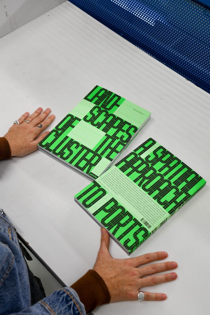
The intriguing title “Landscapes of the Cluster” boldly steps across the gridded cover of this graphically sophisticated book with geometrical precision. Closer inspection reveals that its typeface – “Mecano Clusters” – reflects the spirit of mechanical technology and is also designed by the book’s graphic artists. The character of these landscapes is thereby already implied before we discover their true outlines. From these first impressions, the high graphic quality continues throughout the book, making it a pleasure to explore, while the landscape dimension becomes less obvious as the volume unfolds.
Front and back cover of “Landscapes of the Cluster: A Spatial Approach to Ports”.
Overview
Landscapes of the Cluster is a comprehensive volume in three parts that tackles the emerging technical, economic and administrative properties of the port cluster, aiming to link these to design and the spatial disciplines: Part I – Spatial Approaches; Part II – Performative Maps; and Part III – Shaping Lands. It presents the results of the PULSE research project led by Beatrice Moretti (main author) in dialogue with an invited author group comprising port authorities and members from the engineering, spatial planning, architecture, geography, logistics and economics disciplines. The direct impulse for this study lies in the 2016 Italian port reform, leading to an amalgamation of ports and a reduction from 24 to 16 port authorities.
According to Moretti, the process of European port amalgamations – already underway since 1992 in the case of Algeciras, Tarifa, Campamento and La Línea, and since 1999 in the case of Antwerp-Bruges – distinguishes port clusters from port-city territories as defined, discussed and mapped by Hein, van Mil and Azman-Momirski. Port clusters are also closely linked to port regions; however, the book aims to respond to the research gap on the spatiality of clusters developing within port regions, driven by rapidly advancing networking dynamics and leaving important territorial imprints on a complex range of polycentric sites. The voices of port authorities are important to the book, included both directly in dedicated chapters and indirectly as interviewees and contributors to questionnaires during the research phase. They validate the book’s call to link public and private partners and its ambition to function as a reference and design guide for the port, city and regional institutional sectors.
The work situates itself within the field established by respected researchers and port-city experts that have made important advances in addressing the ongoing transformations of the port-city context, including César Ducruet, Carola Hein and Yvonne van Mil who contribute to this volume. These chapters are complemented by contributions outlining a range of topics influencing port clusters; infrastructure, tourism, maritime heritage, port-city relations and port-territory configurations, plus a series of fascinating historical case-studies including Hormuz, Odessa, Rotterdam and Genoa. Together, this is a rich collection comprising a valuable overview of the topic and its challenges and a stimulating resource for future explorations.
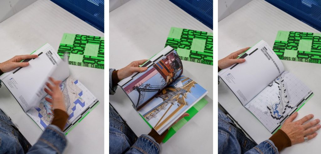
Details of the book’s graphic design. Internal pages showing examples of the maps and spatial indicators.
Method
Understanding the spatiality of the port cluster – its contours, extent, dynamics and challenges – is one of the volume’s primary aims. In addition to the written contributions, the task of pinning down the stretched and amorphous landscapes of the cluster is approached through a “toolkit” that develops a systematic set of indicators (1.1: Investigating the impacts of Port Clusterisation) and a glossary derived from the evaluation of questionnaires during the research phase (1:3. About Cluster and Spatial Engagement. A Glossary of Words). The indicators then inform a series of analytical maps of two Italian port clusters: the Eastern Adriatic Sea/ Trieste & Monfalcone, and the Northern Tyrrhenian Sea/ Livorno, Piombino, Rio Marina, Capraia & Portoferraio (2.3 About Clusters and Spatial Visualisation. An Atlas of Multi-level Maps). Six of the twelve indicators are then translated into a Catalogue of design strategies, that are however articulated in text format only (3.2 About Clusters and Spatial Processing. A Catalogue for Translating Impacts into Actions). The author explains this catalogue as an open question to encourage further study and dialogue, however the shift from technical port cluster terminology to design would have been a vital contribution to a book that aims to bridge precisely this gap.
These sections comprise the book’s major original research contribution and deserve close critical attention. The system of twelve spatial indicators is a crucial starting point since they represent the foundation on which the Atlas, and the Catalogue are based:
- Degree of Sea-Land Connectivity & Geographical Links
- Infrastructure Sharing & Rationalisation
- Services Pooling & Optimisation
- Functional Synergies & Operational Linkages
- Spatial Occupation of the Coast
- Proximity, Inclusiveness, Concentration of Firms/Industries
- Coordinated Planning & Project Tools Between Ports in the Cluster
- Port-to-City & Land-to-Sea Overlapping
- Perception/Acceptability of the Port from/by the Port City Territory
- Heterogeneity of the Port City Territory Interfaces
- Visual Modification of the Port Skyline
- Dual-Function Architectures
The indicators cover a wide range of influential factors, many highly specialised to port operations, and others more comprehensible for the spatial disciplines that have been further examined in the Catalogue (1, 2, 5, 6, 7 and 10).
The mapping experiment which translated these indicators spatially within the cluster operates on two levels: the level of the cluster where the connectivity between its ports is mapped, and the level of the port city territory, where the indicators themselves are colour-coded and mapped.
Explained as “multi-level” propositional maps, the cluster’s outline emerges clearly out of the surrounding land-sea geography in the cluster-level maps, presenting an impressive overview of industrial zones, ownership relations and the impact areas of both ports and cluster.
At the port-city-territory level, the interpretation of the maps is less intuitive and requires careful reading and cross-referencing to follow the graphic notations and imagine their implications. Port-related functions have priority in these maps, while the surrounding city recedes, indicated only topographically. The maps themselves are beautifully executed and certainly provide a valuable basis for further analysis and discussion amongst different governing bodies and interested parties.
While perhaps exceeding the scope of this volume, the reader is curious to understand how firstly the indicators, and then the maps, can be evaluated. According to the team, and to the potential end-users, do the indicators successfully portray the “Landscapes of the Cluster”? Which strengths and weaknesses do the maps bring to the forefront in terms of the considerable planning challenges for port clusters and their urban land- and seascapes? In the book, the term “Landscapes” refers to Charles Waldheim’s landscape urbanism theory. Landscape is discussed by Moretti in relation to terraforming – the manipulation of the earth to support trade, work and human life. However so far in the research, the abstract nature of the indicators and the scale of the maps do not yet divulge how this new clustered landscape is composed in three dimensions and how it could support more-than-human life on land and at sea.
Summary
Moretti argues that port clusters will not only have a major, and partially unforeseen impact on the cities they relate to and the land- and seascapes they are embedded in, but also a major responsibility in terms of the 2030 UN timeframe for the sustainability agenda. This agenda is urgent, with port city territories playing a major leadership role (Sánchez, 262). Within this context, port clusters must embrace a role of environmental stewardship (Van den Berghe, 67), considering the energy transition, sea-level rise and extreme weather events.
Perhaps more than answers, Landscapes of the Cluster results in a series of vital, but open questions to be addressed through future interdisciplinary research. The urgent environmental impacts of port clusters comprise the first group of questions that are referred to but not discussed in detail here. Given geopolitical tensions that intersect port cluster geographies, the dynamics of port clusters are largely unpredictable. Clusterisation aims to streamline port functions, eliminating duplicate specialisations and infrastructure, and optimising both hinterland and foreland connectivity. Ports are identified as drivers of regional economies, but also, as noted by Moretti, are profoundly changing large areas of the planet at alarming speed. The role of port clusters in the “new economic reality… of a deglobalizing world” (Sánchez, 262) is a second field of vital importance that emerges through the book.
Landscapes of the Cluster is an extremely well-researched and beautifully presented volume which will make important reading for public and private institutions and designers working on the future of ports and across the land-sea interface. It articulates a new interdisciplinary perspective on the emerging port cluster typology that combines operational prerequisites with interscalar spatial concerns, thereby inviting scholars and practitioners to closely pursue its further developments.
╝
BOOK Info
Landscapes of the Cluster
A Spatial Approach to Ports
Publisher: Jovis
Year: December 2025
Text: English
ISBN: 978-3-98612-179-2
Pages: 288
Euro: 38,00